![]() Return to
Whittle Wander's page
Return to
Whittle Wander's page
|
Thirlmere, Mines Gill and Helvellyn Wed 29 Sep 2004 |
|
|
It was a miserable misty cloudy day as we set off from the Wythburn car park adjacent to Thirlmere. The first part of the walk was steeply up through the trees, eastwards towards Helvellyn. On reaching the forest track we headed north for a kilometre to the footbridge over Mines Gill. At this point we turned east and straight up the Gill. Presumably because no public right of way is shown on the map the first gate we came to had a huge padlock on it. So obviously we climbed over the fence. Now what on earth is the point of putting a lock on the gate in the middle of nowhere? Does the landowner, United Utilities, think that we'd look at the lock and say "Oh dear, perhaps we better go somewhere else" |
|
|
|
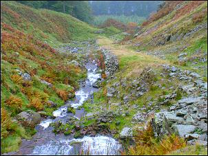
Looking down the Incline from the old Lead Mines above Thirlmere. |
| The first interesting feature of the day is the massive incline running up the gill towards the old mine workings. Before long we were in cloud and the views down to Thirlmere vanished. Climbing up to the right we came to the ruined smithy and stopped for a while to reflect on the lives of the men who worked here. | |
|
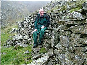
Eric takes a break by the old Smithy. |
 |
|
Climbing higher we came to spoil heaps from the levels that would have originally tunnelled into the mountain to enable the lead ore to be extracted. The mining was stopped in the 1880's by Manchester Corporation Water Works as they commenced the construction of the Thirlmere dam for water supplies to Manchester. |
|
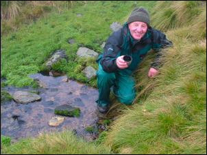 |
Brownrigg Well. Clear water issues from the fellside. |
| Another 10 minutes and we were standing by the summit trig point of Helvellyn, with a panoramic view of NOTHING. The cloud was still a thick as ever. Over by the stone shelter we stopped for our sandwiches and surprisingly sat down on our own. We hadn't seen a soul all day. But it wasn't long before walkers started to emerge from the mist on their way over the top. Our plan had been to continue over Dollywaggon Pike but the thick cloud made this route pointless. So we headed down the main descent route back to Withburn. As always it was nice to stop every so often to chat to walkers on their way up. Comparing notes on ways up, down and other areas to walk is always useful. By Birk Side whe's dropped below the cloud and could see Thirlmere below. |
|
|
|
|
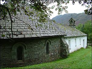
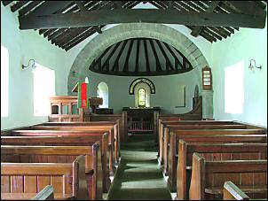
| After reaching the car park we had a look in the delightful little church at
Wythburn, a wonderfully shaped building that seems like nothing else I'd seen. Inside is a notice giving details of it's history. The Church dates from 1640 but there was a chapel here in 1554. While in the car park I noticed a man giving his mobile phone a puzzled look. I knew from previous experience that there is no signal in these parts. He asked if my phone was working and I told him we were in a no signal zone. I then pointed out the Public Telephone box by the road and told him he could make a call from there. "Oh, will that be able to get a signal?" he said! |
|