![]() Return to
Whittle Wander's page
Return to
Whittle Wander's page
|
Anglezarke Moor, Old Rachel's. Thu 21 Apr 2005 |
|
|
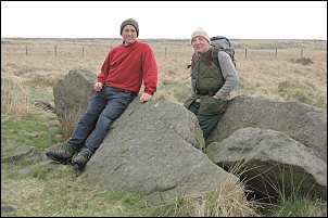
At 7am I set off from Whittle-le-Woods with Eric. We headed east along Town Lane and at the Lancaster canal followed the towpath to Whittle Springs and Dark Lane. An old photograph of the WAP house had turned up and we viewed it while looking at the existing ruined remains. At the end of the old line of Moss Lane we crossed to the old Blackburn Road and followed the path across fields and under the old railway viaduct to Tithe Barn lane. We then followed Higher House lane, then up to the reservoirs. We now had a good view of the moors in front of us and soon arrived at White Coppice. At this time of the morning there was nobody about and we pondered on how things would have been in times past. On our left was an empty field where previously was the cotton weaving mill that provided employment for the area. After the cricket field we headed up 'the Gorge' and through the old quarries to emerge on a narrow path on the moors. This was the last path we'd be following for a while. Our first main objective was Hurst Hill and its isolation and lack of access path guaranteed we'd have the place to ourselves. After stepping over Black Brook we headed due south and up on to the moor. Although tussocky the going wasn't too bad and much better than if we'd been battling through heather and bracken. I always reckon Hurst Hill to be one of the best viewpoints in the area. Unobstructed vistas of the lowlands stretch out to the west as far as the sea. Surely our ancestors used this spot to keep an eye out for interlopers? But nothing of archaeological significance has been found in the vicinity of the hill. |
|
|
|
After a coffee stop we continued to the 'Pike Stones' chambered cairn, close to Jepson's Gate. This was Eric's first visit to the monument and a nearby sign showed a 1950s survey of the area and an artist's impression of how it may have looked. |
|
|
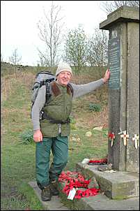
We were now back on to a faint path and soon reached the track to the monument on the edge of Lead Mines Clough which was erected in 1955 to remember the crew of a Wellington bomber who were killed when the plane crashed on the moor in 1943. I'd always thought the plane just crashed into the moor but evidence suggests that it began to break up at high altitude and crashed out of control. When the wreckage was found there were only 3 of the 4 engines at the crash site. It was another 12 months before a single engine was found in woods near Darwen, about 4 miles away. |
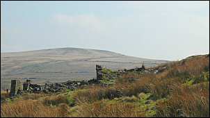
| Our next objective was to check out some of the farmhouse ruins towards the head of the infant river Yarrow. A well made track was easily followed to 'Simms' where we descended to the river and crossed over to reach the ruin of 'Old Rachel's' Here we stopped for our lunch break and imagined what life must have been like for previous occupants. The warm sunny day that the weather reports promised hadn't quite materialised, so we had to find what shelter we could from the cold wind. | |
|
|
|
|
An easy, but very wet in places, path took us to Wilcock's Farm and the road. As we walked to Alance Bridge we remembered the Commonwealth Games of 2002 and the cycle races that were held here. It seemed like only yesterday that I shouted and clapped the riders up the steep hill from Alance Bridge. At Anglezarke reservoir we followed the track by Leicester Mill Quarries and up to High Bullough reservoir. We stopped to marvel at another feat of civil engineering. The reservoir was built in the early 1840s and was the first to feed the expanding town of Chorley. After the outlet a tunnel took the water under Healey Nab to the treatment works on the west side of the fell. |
|