|
Howgill Fells, Longdale, Docker Knott, Simon's Seat.. Wed 12 Oct 2005 |
|
|
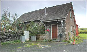
Drove through heavy rain and a dark morning up the M6 to Tebay and then east to the small hamlet of Longdale. Maybe hamlet is an exaggeration. It's been too many years since I had a day walk in the Howgill Fells so I thought I'd better put that right. The collection of houses and farm is very compact with a very narrow road servicing them. I had a bit of trouble finding somewhere to park my car but eventually found a place that didn't cause an obstruction. I was using Wainwright's Howgill Fells book as a guide, which suggests parking by the school, but I couldn't see one. I couldn't even see the start of the walk and had to ask a local lady who'd just got back from walking her dog. She was very helpful and told me the way. No wonder I couldn't find the turn off as it looked like the entrance to a private farm-yard, the old school was there, now converted to a private house. |
|
|
|
While walking up the lane another friendly local gave me directions as she waved her husband off to work. We shared an interest in photography, she'd noticed my tripod in hand, and we chatted a while before I set off up the muddy track. Heavy overnight rain didn't help the progress and as I reached the first stone bridge over Langdale Beck the rain started again. At Long Gills farm I joined a stoned track, which followed the wall up the fell until it deteriorated into wet rushes and bog. |
| I had to make wide detours here and soon found myself on a very nice path that descended into Uldale End. I was now rapidly approaching the cloud level and was soon enveloped in it with nothing to see but the ground immediately in front of me. I stopped for a coffee at the first sheepfold then pressed on to the second. Soon after I reckoned I was at Blakethwaite Bottom, but couldn't see a thing. The county boundary stone that Wainwright refers to was lost in the mist. I took a compass bearing and headed steeply up the east side of the valley to reach Docker Knott. It was nothing more than a flat grassy summit with a small pile of stones and sheep skull. With nothing to see I continued on compass bearings to descend into Stowgill Brow and then up again to Simon's Seat. The flat summit also had a very small pile of stones to mark it, but no skull. They must have been carried up in recent decades as Wainwright describes the peaty summit, | |
|
"disappointingly has no cairn and no material at hand for making one except for sheep-droppings, which lack the necessary attribute of permanency." |
|
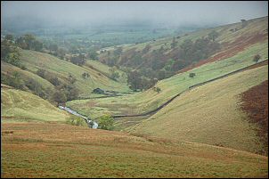
| A NW compass bearing took me down the long ridge of Middleton to the OS trig point and down to the valley bottom. As I came out of the cloud I had a nice view down Langdale and could see the substantial ruin of High Shaw in the distance. |
|
|
|
|
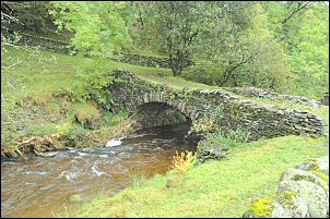
| The bridge over Langdale Beck was a delightful narrow stone arched packhorse bridge which looked like some recent pointing had been done. | |
|
|
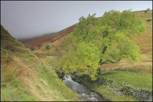
Following a path along the east side of the river I passed opposite High Shaw ruins and soon came to another stone arched bridge. This one being much wider and probably a major access to High Shaw many years ago. I kept to the river bank and wandered along flat meadows until I re-joined my outward route at the first stone bridge. |
|
The Old School |
|