|
Baugh Fell, Yorkshire. Fri 16 Dec 2005 |
|
|
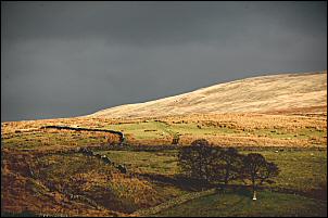
Drove through Sedbergh and on to the A684 Garsdale Road. Left car at the Tom Croft Hill car park then walked down the narrow lane and across the bridge over Clough River. Up the other side of the vally I climbed to Garsdale Foot, which appears to be a restaurant but nobody was around. Before I left the road and stepped onto the fell I had a nice view of the setting almost full moon. It's supposed to extra big at the moment but I can't say it looked much different to me. |
|
|
|
|
|
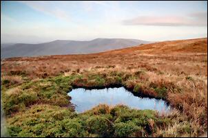
Once on the fell I followed a couple of tracks, one indistinct, until I came to the wall that marks the line of Ringing Keld Gutter. The line continues east and up the side of Baugh Fell, which was my objective for the day. I'd first seen the fell while walking over the Howgills and thought it looked interesting. So here I was, hoping to find out. There wasn't much of a path line but as I approached the last steep bit to the top of the fell there was a zig zag track cut into the fellside. At Knoutberry Haw trig point I had very good views all round, the Howgills to the NW and Wild Boar Fell to the NE. I continued following the wall over Tarn Rigg Hill then across the peaty bog to East Tarns. The fell top is an interesting mix of soft wet bog and firm stony areas. |
|
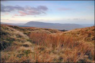
 Towards the Howgills. |
|
|
|
Heading back west I came across areas of old quarry workings and some old ruins. Then an even larger area of workings came in to view. These are marked on the old map as flag quarries. It was the ideal place to find a bit of shelter and have my sandwiches before descending the fell back to Clough River Bridge. |
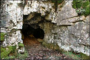
| Before returning to the car I followed a good path along the river to Tom Croft Cave which isn't very large but worth a look. Cutting directly up the hill I returned to the car park. | |
|
|
|