|
Milburn, Great Dun Fell, Little Dun Fell, Cumbria. Wed 03 May 2006 |
|
|
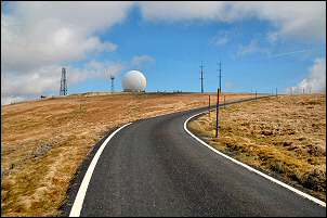
I arrived in the small village of Milburn, nr. Penrith, Cumbria, in sunshine. My objective was the summit of Great Dun Fell but that was obscured in cloud. At least it wasn’t raining as I set off south along the road. The last time I tried for the summit it was cloudy and raining but at least there was no rain this time. I’d decided to get to Great Dun Fell and the Radar Station by the quickest route so I followed the road. At Milburn Grange a group of floral tributes and spray paint position markers on the road indicated some tragedy had happened here fairly recently. A little further on was the garage and filling station. This puzzled me as I was on a minor road with hardly any traffic, so not much passing trade. Just after that is a minor road leading off to the left. After passing a few nice old stone houses the road snaked up ahead and into the cloud. There is no indication of the importance of this road other than a sign on the right saying ‘Great Dun Fell NATS Radar Station National Air Traffic Services Ltd.’ By the time the tarmac road reaches the Radar Station it is the highest road in England at 847m (2779ft) |
|
|
|
Fortunately, as I walked up the road the views began to improve and by the time I’d reached the branch road to the Silverband Mine (not a silver mine!) the clouds had blown away. But it was blowing quite hard and the cool temperature of 8deg C meant that I had to find some shelter in a sink hole to have my first coffee break in comfort. I reached the Great Dun Fell Radar Station with its characteristic huge spherical white golf-ball profile. It can be seen from miles away as you would expect for a structure that is designed to be in a prominent position, so it can monitor its share of the UK air traffic. The wind made it feel too cold to hang around and although there were several cars parked outside the buildings there was nobody around. |
|
I followed an easy track to the north west towards Little Dun Fell. Fortunately there was a handy stone wall shelter so I had a few minutes break from the wind. At this point I measured the wind speed as 34 knots. |
|
|
|
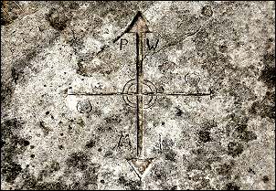
I continued to Tees Head and the junction of paths that are denoted by a nice carving in a stone slab. I turned left to start my descent but was soon making detours to avoid large areas of boggy ground. I used another large sink hole as a handy shelter to sit quietly for a while and eat my butties. |
|
By now the bulk of the clouds had blown away and there were nice views all around. The continuing descent was a delightful path which was now quite dry and easy to follow. I followed it down past the wonderfully names Grumply Hill and on towards Wythwaite. I was now out of the wind and it was quite warm in the sunshine. I followed a path south to get back to Milburn but the footbridge at Crowdundle Beck wasn’t over the river but sat on the grass at the site. Obviously of no use as a bridge so I had to hop and partly wade across the river. Its lucky it was low as it would have been a boots off and wade job otherwise. A series of new stiles took me to a farm track and back to the village. |
|
|
|
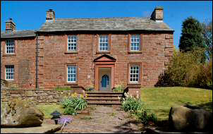
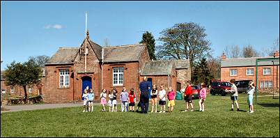
The sky was now clear and the full sunshine showed up the sandstone buildings at their best. Some of the children at the village school were enjoying games in the afternoon sunshine. A short walk across the freshly mown and extensive village green and I was back at the car. |