|
Old coach road, Clough Head, Dowthwaite Head, Cumbria. Wed 31 May 2006 |
|
|
The weather was great when I left home but as I drove over Kirkstone Pass and approached Dockray the clouds rolled in. I parked at the eastern end of the Old Coach Road and set off west towards Clough Head. Although some clouds had rolled in it was still pleasant walking and I just ambles along wondering why the far fells were all bathed in sunshine but I wasn’t. |
|
|
|
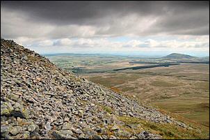
And as I got nearer to Clough Head the sunny slopes became overcast slopes. I continued along the old coach road until I came to the stile that took me onto the fell and straight up the NE ridge of Clough Head. Lower down it was nice firm dry grass but higher became more stony. The good views made up for the lumpy ground though. I’d left the still and warm walking of the old road and was now in a fairly cold wind. |
|
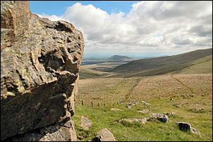
It was no place to linger as I reached the trig point on Clough head so I continued straight on to Calfhow Pike. I always find this a pleasant spot to have a sit down and take a break with my flask. |
|
|
|
I found some shelter from the wind and a comfortable patch of dry grass to sit on and before long was getting far too comfortable. Reluctantly a collected my things and set off for Great Dodd. It was a steady pull but quite easy. On the summit is a low stone shelter, where I stopped for a moment to take in the view. As I sat there a fell runner approached, said a brief hello, and shot off again. |
|
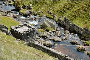
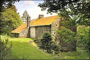
My objective was to check out a flat shelf of land on the side of the valley that sources Aira Beck. I couldn’t see my objective because of the geography but the characteristic shape of the mountain made route finding quite easy. Before long I could see the flat area blow me and just above Lurge Crag. It was a nice flat area with a good water supply close by. I wanted to check it out as a possible camp site. It was quite good but there was no shelter in case of wind. I descended to Randerside Fold and picked my was as best I could across the very wet area of Dowthwaite Head Moss. As the river starts to fall rapidly down into the deep Rush Gill a nice ancient green track follows easily down the gill at a higher altitude. Below I could see the water intake building which is shown on the map, but there is no way of knowing if it is still in use. |
|
|
|
Lower down a ‘Permissive Path’ sign diverts into an area of old walls and no obvious route. I continued down the green lane, through a gate and found an alternative way down to the road. A mile walk took me back to the car park. |