|
Patterdale, Boredale Hause, Slee Fell, Place Fell. Cumbria. Thu 04 Jan 2007 |
|
|
|
|
|
I checked out two separate weather forecasts before leaving; one said clear skies all day, the other, rain all day. I arrived in Patterdale to overcast skies but no rain. Both forecasts turned out to be wrong. There must have been a lot of recent rain as there were shallow floods over some stretches of the road from the Kirkstone Pass. It was still very dull when I set off, firstly along the road to Rooking then I followed the path diagonally up the fell to Boredale Hause. My first point of investigation was ‘Chapel in the Hause’ shown on the Ordnance Survey map. The last time I was in the area everything was covered in ferns but as it is now January I didn’t have that problem. I’d followed the higher of the two paths up the fell side and it took me directly to the ruin of the Chapel. On the 1860s map it is shown as a ruin and must have been of some age. Rain had threatened but didn’t materialise, though the wind seemed to be increasing. |
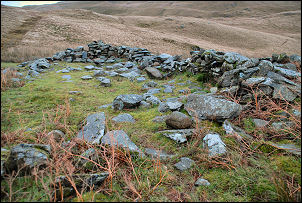 Chapel in the Hause (ruin). |
|
|
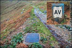
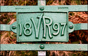
I continued over the pass and started the descent into Boredale. As I descended I was in the lee of Place Fell and found some shelter from the wind. The first part of the descent was quite steep and I noticed a piece of broken cast iron pipe amongst the rocks. A little further on was an air valve chamber lid and a marker post. This all added up to a water pipeline running down to the valley. The source of the water would probably be Hayeswater reservoir, about 3km to the SE. According to the map the water level is about 425m and the Hause is at 399m, which means the water could easily gravitate over the pass. |
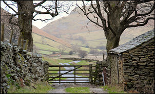
| I took the path through Boredale Head yard but there wasn’t much going on. It didn’t seem like a working farm even though it was lived in. |
|
|
|
Further down was a nice terrace of stone cottages called Nettleslack with a sign advertising holiday accommodation. Passing Garth Head I took the left branch and down to a delightful grassy patch by Boredale Beck. It would be perfect to drive to for a picnic in the summer. Before I got to the end of the lane at Sandwick I took a path to the left. |
|
This is the main route up Slee Fell but it skirts the NW side of the fell without going over the top. I saw a minor path taking a direct route up north ridge towards Cat Crag, so that was the way I went. It was a steep and steady climb but as I got higher the wind became much more of a problem. I was much happier when I got to the top and away from the steep drop off the wind was trying to blow me over. There was a large cairn at the top and a faint path heading south. I followed it to Steel Fell and up a diagonal path towards High Dodd. |
|
|
|
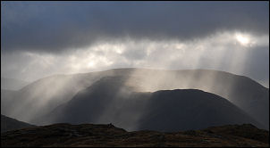
I left it part way up to make the direct climb to the summit, where there wasn’t a cairn, and down again to the sheepfold at Low Moss. I was glad to reach it as it was the only place where I could get some shelter from the wind. I decided to stay a while and have my sandwiches and coffee. The map shows the path splitting so I took the left branch as I hoped it might have better shelter from the wind. When I got to the summit trig point on Place Fell I had a lot of difficulty getting to the top because of the wind. I must have looked very strange as I clung to the column with both arms wrapped round it. A short blast of rain hit then some clear patches allowed a few shafts of sunshine through, though they were very brief. In the distance I had some dramatic views of Brothers Water and Kirkstone Pass. |
| I started my descent and I got lower the wind eased. I reached the Hause and decided to look for the Ordnance Survey bench mark that is shown on the map. They are normally chiselled into buildings but where none are available they cut them into large boulders. I saw a couple that seemed to fit the bill. I didn’t see the familiar arrow shape first, just the head of the metal bolt that denotes the altitude. Then I noticed the arrow shape converging on the bolt. I followed the path back down the way I’d come and returned to Patterdale. |
|
|
|
|