|
Kirkstone Pass, St Raven's Edge, Wansfell Pike, Ambleside, Cumbria. Wed 14 Feb 2007 |
|
|
|
|
|
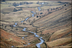
I had a call to make in Ambleside so decided to make that part of my route. Finding a parking space in the town is a major challenge. There seem to be double yellow lines circling it to a radius of at least a mile. I drove up Kirkstone Road towards the pass and just kept going until I found the road wide enough to park safely. The original weather forecast had been bad, with rain for most of the day. The sky was clearing as I set off and no rain had been seen so far |
 Kirkstone Road towards Windermere. |
|
|
I headed up the road towards Kirkstone Pass but before the summit I passed the entrance to Kirkstone Quarries with ‘keep out’ signs. |
|
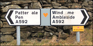
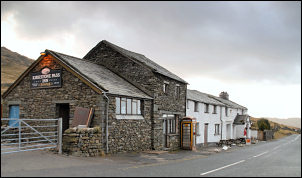
At the top of the pass I came to the Kirkstone Pass Inn with a date of 1496 over the door. It’s a pub I’ve never been in but must put it on my list. It is the highest Pub in Cumbria and the third highest in England after the Cat & Fiddle (2nd), Macclesfield and Tan Hill Inn (highest), near Reeth, North Yorkshire. I followed the road for a short way then took to the fell on the left and across to the Kirk Stone. This was an ideal spot to stop for a cup of coffee and take in some of the surroundings. The weather was good but the sun hadn’t risen high enough to reach me. The map shows a faint path up towards St Raven’s Crag and this is where I was heading. |
|
|
|
I rejoined the road and dropped down towards Brothers Water. I could just see the line of the zig zag path up to my right and climbed the wall to join it. |
|
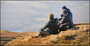
This is another of those many tracks that have been engineered up the hillside with no obvious destination at the end, i.e. Quarry etc. There was a nice flat spot near the top with a water source adjacent, but no mobile signal. I emerged on to a flat area at the north end of St Raven’s Edge and decided to stop for lunch, even though it was still quite early. A cold wind was blowing but I found a large boulder to shelter behind with a nice grassy patch to sit on. A group of walkers were approaching in the distance but they took ages to arrive. I was off the main path so they didn’t see me. The path follows the wall and I headed south along St Raven’s Edge until I arrived at the summit cairn. |
|
|
|
The main path descends directly to the Inn but I wanted to take another route which didn’t seem to have a path. I descended to the south in the direction of Wansfell Pike. Although there was no path it was easy and pleasant going. I took my time as I wandered around minor tarns and then down to the Kirkstone Pass road coming up from Troutbeck. There was now an ‘Open Access’ map and information board up which wasn’t there the last time I was here. |
|
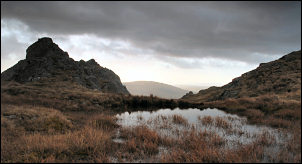
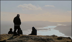
A route was shown across the flat area towards Idle Hill but the crossing is far from straightforward. The last time I was here I had the same problem, horrible bog. I made it to the far wall but not without getting my feet soaking wet. Once over the wall it was a pleasant walk along the ridge to Wansfell. The views were great and more people were about. |
|
|
|
At the summit cairn many people were arriving after climbing up from Ambleside. The descent to the town was steep at first then an easier path took over. Nearer the town there was a branch path that I took round Stockghyll Force waterfalls. It was quite pleasant but I couldn’t get very good views of the falls because of branches in the way. In Ambleside I called in the Adventure Peaks shop to see Zak then continued my walk up Kirkstone Road and back to the car. |
|
|
|