|
Ennerdale Water, Lingmell, Tewit How, Haycock, Iron Crag. Cumbria. Tue 27 Mar 2007 |
|
|
|
|
|
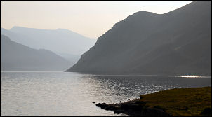
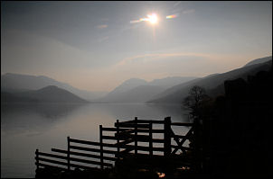
I had a pleasant drive to Ennerdale Bridge village. It was sunny and hazy with little wind. I used the spacious car park at Bleach Green Cottages and set off along the path on the south shore of Ennerdale Water. I could see the sun but it was very hazy and quite chilly. Anglers' Crag loomed up out of the lake but the distant hills were hardly visible at all. There is a path over the crag but I didn’t take it and kept to the lakeside path. It was easy going and I enjoyed the quiet and solitude. I’d seen a couple of people walking their dogs near the car park but now I was on my own. |
|
|
|
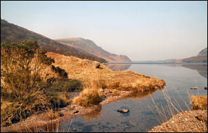
It’s a long time since I’d been on this path. The first time was when I did the Coast to Coast walk in about 1980 with Charlie. As I approached the wooded area the path became more rock and difficult though some levelling seems to have been done since my last visit. At the end of the lake I emerged on to a wonderful green field then through a gate and on to a wooded forestry track. |
|
|
|
|
In Lingmell Plantation a muddy path shoots straight up the north end of Lingmell. This was the path I took and I kept a slow steady pace up the steep climb. A couple of wooden benches were conveniently positioned about half way up the steep bit. I used one for a quick breather then continued till the gradient eased. The faint path seemed to vanish altogether. I then found myself wading through deep heather which was quite hard going. My objective of Haycock appeared before me but seemed an awful long way off. |
|
|
|
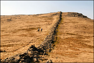
Eventually I was on the steeper slope of Tewit How and thankfully left the heather behind. It was a very interesting area with many humps and hollows with small streams and the occasional clear spring. The saddle between Scoat Fell and Haycock was up to my right and I took a diagonal route until I reached it. The remains of a dilapidated wall runs along the ridge and as I followed it to Haycock summit I noticed a couple of walkers who’d come up from the Wastwater side. |
|
The wind had now increased and on the summit I looked around for some shelter for my lunch stop. The north side of the peak is very bouldery and I found a nice sheltered spot to eat my sandwiches. The descent to Little Gowder Crag was tricky through the boulders but soon improved as I reached more open ground beyond. I was glad the weather was good as mist and rain would make navigating difficult up here. On Caw fell I turned right and steeply down to follow another climb and wall over Ennerdale Fell. It was a long way and seemed to take ages before I reached the pass before Crag Fell. I decided to descend back to the lake here but there was little evidence of a path. On the way down I came across some old mine workings and a few wooden posts were all that prevented entry to the mine. The spoil heap was mostly red stone and the river running down to Ennerdale Water is not surprisingly called Red Beck. Presumably the mine was for iron ore. The descent wasn’t too bad and I when I reached the lake path I turned left and back to the car park. |
|