|
Wast Water, Seatallan, Middle Fell, Cumbria. Wed 18 Apr 2007 |
|
|
|
|
|
It was a nice sunny morning as I approached Wasdale but the nearer I got the more cloud there seemed to be. The SW end of Wast Water must be one of the few places where car parking is not a problem. I continued along the lake road for a while then took the left turn to Greendale, where I parked off road on a patch of grass that would put my lawn to shame. I headed west along the road until I came to the concrete access road leading up to Windsor Farm. I headed up it until I came to the farm which was being substantially renovated. There was nobody around and I couldn’t see an obvious path through the farm. Another look at the map showed that I should have been a bit higher on the fell to join the side of the boundary wall. There were no signs or obvious evidence of a path, which is strange as it is an old bridal way. I didn’t stay with the wall long as I wanted to climb Seatallan by the more interesting route via Cat Bields. Wainwright’s book recommends this way saying the bridal way is dull. I turned right and with nothing to head for just went for the highest ground I could see ahead. I came across an old stone shelter which seemed to be of considerable age but I couldn’t find the Buck Stone which is shown on the map. |
 An interesting stone shelter. |
|
|
|
|
The NW slope down in to Stockdale is quite formidable so I moved round the plateau until I could see a more leisurely gradient down towards the Pots of Ashness. It was easy going and I arrived at a nice grassy area with occasional damp patches and small boggy patches. |
|
|
|
I crossed the main trail up from Greendale Tarn and headed up Middle Fell. The scenery was quite interesting as I climbed the path. Large rocky outcrops continued all the way to the summit. As I continued the views down to Wastwater got better. |
|
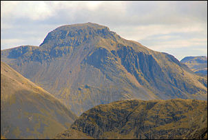
Eventually I could see the full length of the lake with the dramatic screes behind. It was an interesting area of many minor summits and intricate wandering paths. I could see the road below then my car so I just headed in that direction until I came to the main descent path. I then followed it back to the car. The weather had stayed a bit cold and mostly overcast but the occasional bit of sun broke through, but not enough to warm things up. |
|