|
Leck, Ease Gill, Gragarath, Lancashire. [19.5km] Thu 13th Dec 2007 |
|
|
One of the main problems of walking on the middle of winter is arriving at the start in the dark. I drove past Kirkby Lonsdale until I reached Cowan Bridge then turned left up the narrow lane and through Leck. It has been many years since I was in this area and had no idea what the paths were like, hence today’s walk. The lane was too narrow to leave my car so I just kept driving until a wide enough piece of grass verge appeared in my headlights. It was by a gate where the path to Leck Mill started but the gate was tied firmly shut so I had to climb over it. After crossing a field I began to descent to Leck Mill which turned out to be a rather grand conversion into a private house. It looked quite attractive in the morning gloom with its lights and some Christmas lights on an adjacent tree. |
 Leck Mill |
|
|
I joined the main footpath up Leck Beck which turned out to be a farm track. I followed it through Springs Wood then out into open fields. I came to a wooden building with windows and curtains. A fence round the outside said ‘private’ but there was no indication what it was. A little further on a woman was returning after walking her dog and I asked her. ‘It is a shooting lodge’ she said. The track became a path and wound to the right and up a side valley. The ruins of Anneside came into view and I had a quick look round before continuing across a deteriorating path which was quite wet in places. I came back to the river, which was mostly dry, and continued up the right hand side. I was now over the Ease Gill cave system and various potholes were dotted around. Some had been quite familiar in about 1980 when I was with the Red Rose Cave and Pothole Club. |
|
Eventually I crossed the river to the other side to try and find some better ground, though I didn’t seem to make much difference. At Long Gill Foot I left the gill and headed up towards the wall that heads for the County Stone. The wall denotes the boundary between Lancashire and Cumbria. It was still cold and clear and at last I was walking in sunshine. At the stone, which used to mark the junction of Westmoreland, West Riding of Yorkshire and Lancashire, I crossed the wall and turned right towards Gragarath. |
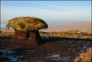 View from Gragarath |
|
|
I soon had to cross the wall back into Lancashire and follow the faint and wet in places path. Nearing the summit I turned a bit to the right and headed across open land to the trig point on the summit Gragarath. I checked out the old 1850s map of the area and it was called Greygarth then. A better path then continued down towards Leck Fell House and the cairns called ‘The Three Men of Gragarath’. After the Three Men there didn’t seem to be an obvious path so I picked my way down to the green track just above the farm. I was soon on tarmac and completed the final miles along the road back to my car. I’d been walking on new territory almost all the way. |

