|
Barbon, Middleton Fell, Castle
Knott, Cumbria. |
|||
|
Start/finish SD 6303
8243: |
 Barbon remembers. |
||
|
|
|||
|
|
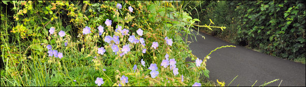
It was a warm sunny morning but there was a lot of haze about so not much to see in the distance. It soon began to warm up considerably as the weather in recent days has been quite hot. The trees and bushes were now at their maximum growth rate and some of the side paths were totally inaccessible due to head high grass and bushes so I kept to the road. I took the minor access road to Low Fellside, hoping to pick the railway route up there. It didn’t look too good as a lot of junk had been dumped on it so I kept on to the end of the track and turned left to pick a path up across fields towards Mill House. There was an old stone house being renovated to I stopped briefly to chat to the workman and his assistant. |
||
|
The group of buildings at Mill House looked more like holiday cottages as there was nobody about. The path took a diagonal line across fields to reach the railway route at Tossbeck. I stayed on the railway for a while which is reasonably easy to walk along even though there doesn’t seem to be a right of way. Near High Green there was an information board by the bridge giving information about ‘permissive access’. I can’t see how anyone could know about such information as you have to apparently trespass to find out about it. After crossing Larum Gill I left the railway and followed a farm track heading NE up the hillside. It climbed steadily to Raismoor where it vanished near the side of a deep ravine down into Luge Gill. The valley widened out and I was able to get easy access to the river and cross it near Cartsaddle Hill and take a steady line up to Middleton Fell. |
 Eskholme Pike. |
||
|
|||
|
|
Part way up I came to some areas of limestone outcrops. It was the perfect spot to have my lunch stop and take in the hazy surroundings. I continued up Middleton Fell to pick up an old track which took me to the summit ridge at Calf Top, just below the trig point. Middleton Fell is a gentle and easy way up Calf Tope but the view I now had was a very severe drop off into Barbondale. It really is a superb view and I kept glancing across to Crag Hill as I wandered down the path towards Castle Knott. The steep descent is soon followed by a climb up and an easy path winds down Thorn Moor to Eskholme Pike. This is another interesting outcrop and was worth a short stop and investigation. Then there was a steep descent to a path which followed the contour to the Barbon Manor access road. It was then a short walk back to the car. I stopped to photograph St Bartholomew’s Church but the door was locked so I couldn’t get inside. At the car I spoke to the man who lived at Dale End bungalow. A stone roller was mounted on his wall so I asked him about it. It was very old and originally used for rolling the fields flat. It was being mounted on a wall that puzzled me. |
||