|
Sawley, Gisburn Park, Paythorne,
Rathmell, Settle (Ribble Way - part) |
|||
|
Drove to Eric’s for
6:30am and then we drove in our own cars to Settle. The objective was to
walk another section of the Ribble Way from Sawley to Settle but as
there is no public transport between the two locations we have to use
two cars. I left my car in Sandholme Close off Station Road, Settle and
we then drove in Eric’s car via Wigglesworth to Sawley where we parked
opposite the Spread Eagle Inn. |
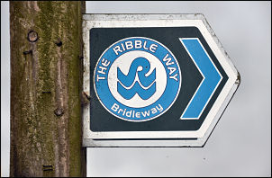
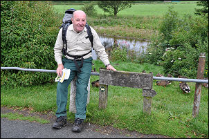 Eric by the way-marker in Sawley |
||
|
|
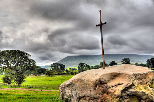
I had the 1:25K OS maps with me while Eric was using a recent ‘Ribble Way’ guide book. I also had a copy of a Ribble Way guide but it was probably one of the first, written by Gladys Sellers, and now out of date. Passing through Dockber we headed along a farm track then diagonally through a field to a ruin called New Laithe. Some water taps were around on wooden posts indicating the area was sometimes a caravan park. No water was in the taps. Across the next field we came to some old empty caravans and a new stone circle of old gate posts and pieces of stone. Nearby was another stone with an iron reproductions sword set in it. A sort of reproduction Excalibur. |
||
|
|
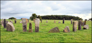 New stone circle |
||
|
|||
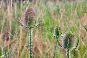 Teasels at Gisburn Cotes Farm |
We took the riverside option so that we could at least see the river for the first time since setting off from Sawley. The path didn’t stay with the river long and we soon climbed up again to a barn called New Laithe, yes, another New Laithe. There was a low wall at just the right height to sit on so we took the opportunity to sit down and have a coffee. Further on we passed Wheatley then approaching the farmyard of Higher Laithe where a way marker pointed us across a wet field and down to a narrow footbridge over Wheatley Beck. Up through woods we came to an open field with no indication which way to go. Ahead was a fenced property with ‘no entry’ signs. The correct route was thorough Coppice Farm but it wasn’t visible. We headed up the field and to the left to get round the double barbed wire boundary. It was Coppy House and soon we could see the actual house across a large lawn. It was an incredibly horrible colour of pink. Why would anyone paint their house pink? Except if your name was Barbara Cartland. Our detour took us round Coppy Wood where we emerged back on to the correct route at Mill Lane. |
||
|
The map says turn right and follow the lane to Gisburn then along the busy A682 where there is no footpath. Eric’s book suggested turning left and down to Gisburn. This seemed a far more sensible route so we took it. By the bridge is group of buildings, one with an interesting group of stone coats of arms. There also another brief view of the River Ribble. We followed a rough road up to Gisburne Park where we had a view of the big house before we took a sunken track down to the river. We followed a rough track up through Temple Wood and emerged on to the busy A682. For a while there is a rough path on the field side of the hedge but soon we had to walk on the road itself as there was no footpath. Thankfully at Castle Haugh Hill we were able to leave the road and head off across the field and down through woods to the road at Paythorne Bridge. |
 Gisburn Park - coats of arms |
||
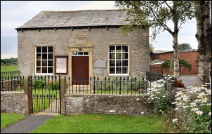 Paythorne Wesleyan Chapel dated 1830 |
This is a minor road so
there wasn’t much traffic about. We walked up Kiln Lane into Paythorne
where we overshot the turn off to the right. We returned to the correct
point at the Buck Inn but before continuing we sat down at one of their
tables to eat our lunch. The Inn was closed so we weren’t causing a
problem. Adjacent is a nice Wesleyan Chapel dated 1830 and a ‘visitors
welcome’ sign. But it was locked so no chance to look inside. |
||
|
The ground is the most horrible mix of bog, tall grass and mire. How anyone can design a route across it is beyond comprehension, especially when there is a simple alternative. Turn left at the flat bridge and follow the path to the lane. After many detours to avoid wading through swamp we emerged near Halton West. As we arrived a cyclist was changing an inner-tube on his punctured bicycle wheel. We headed up brook lane where we were diverted through more deep grass and no obvious way ahead. We ploughed on, climbing a barbed wire fence, to eventually pick up a way-mark sign. It said follow the diversion signs, but there were none. Near High Scale we had to retrace our steps as we’d missed the unmarked path across fields to Deepdale. There was then Todmanhaw Lane all the way to Cow Bridge End. |
 Eric ploughing through the high grass. |
||
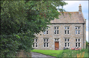 Wigglesworth Hall |
We left the road again to head across fields and along a ridge covered with head height grass. The River Ribble was nearby but because of the flood embankments we couldn’t see it. We passed Wigglesworth Hall Farm but didn’t see much of the buildings because of trees. |
||
|
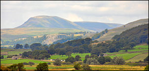
Over Seed Hill we began
to get nice views of the hills ahead. We’d been able to see Ingleborough
for a while and now Pen-y-Ghent came in to view. The day had been
warming up for a while and Eric hadn’t brought any water, just a flask
of coffee. He was becoming dehydrated and slowing down. At Hollow Gill
Bridge he struggled to climb out of the valley so we decided to cut
across the field to the road to Rathmell and Eric would walk slowly to
the village to get some water while I walked on my own back to the car
then return to pick him up. I increased my pace and walked along the
road, which unfortunately didn’t have a footpath over most of its route,
all the way back to my car in Settle. |
|
||
|
I managed to cover the 4 miles in 55mins. I
drove back to Rathmell to find a recovered Eric sat by the War Memorial.
There was no shop or pub in the village but Eric had got water from some
stables. We then drove back to Sawley where Eric picked his car up and
we both drove home. My main comment on the day is that calling this the Ribble Way should be an offence under the trade descriptions act. We had seen very little of the river and most of the time we were on ill conceived and pointless paths. The earlier walk we did from Ribchester was pleasant because we were walking along the river. Today’s stage was by no stretch of the imagination a riverside walk. It would be better to call it something else and not waste people time thinking they are going to see the River Ribble. Distance path designers should follow in the footsteps of the master. Read a few guide books by Alfred Wainwright. |
|||