|
Tarnbrook, Wolfhole Crag, Roman
Road, Whitendale, Millers House, Forest of Bowland. |
|
|
SD 5834 5574 |
 Approaching Tarnbrook |
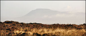 Ingleborough from Brown Syke |
I walked back to the houses in early morning sunshine and took the track towards Tarnbrook Fell. This is the first time I’ve walked in this particular area and it was very pleasant seeing new views opening up. About half way up I came to an interesting stone marker with LCWW 1878, presumably Lancaster Corporation Water Works. The well made vehicle track continued to the summit at Brown Syke and beyond. I turned right to follow a faint path along the fence. It was the usual mix of not too bad and wet which it typical for this type of terrain. |
|
As I gained height the ground became better with some interesting rocky outcrops. At Wolfhole Crag there were even more and the O.S. trig point seemed to be perched on top of a pile of boulders. Presumably the surrounding area has eroded away. I followed the wall for a while until I reached a fork in the path. To the right was White Crag but I was following the fence to the left towards the old Roman Road. It was fairly rough going in places and would be very boggy in wet weather. |
 On Wolfhole Crag |
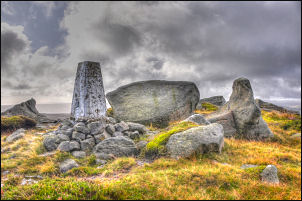 O.S. trig point on Wolfhole Crag |
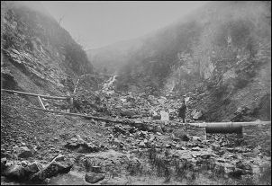
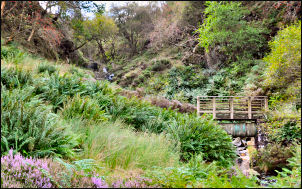
I reached the Hornby Road, which is a track on the line of the Roman Road. I turned right but didn’t get the advantage of its easy going for long. I was heading down Whitendale and the path shown on the map seemed a bit vague. Fortunately there was a marker post showing where it started and other smaller posts marking its route through he rough moor. I reached the valley bottom and eventually a better path emerged. The valley opened out into fields then a farm track appeared which I followed to the Whitendale Farm buildings. The farm road ran down the west side of the river but I wanted to follow the path along the opposite side. I asked a man where it was and was told there was a ‘closed path’ sign but it was still possible to get through. The first part was quite wet but it got better. I’d brought some paper prints of old water works intake photos from the 1880s with me and one was supposed to be in Costy Clough. When I reached the clough there it was. The same view from 130 years ago. |
|
|
|
|
I continued to a footbridge and crossed the River Dunsop. I was walking to Footholme to check another old photo of a pipe bridge when a car pulled up. It was Pete Guy who I used to work with in the days of United Utilities in a previous life. We chatted for a while and he drove off the Whitendale while I walked to Brennad Farm along Brennand River. On the way a man was rebuilding a dry stone wall but I still had a long way to go and didn’t have time to stop and chat. I had an old photo that is supposed to be Brennad Farm but when I spoke to Jeff Walker, the Farmer, he said it was Bishop’s House further down the valley. I continued up the valley, following the line of the water aqueduct. |
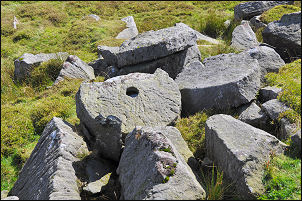 Unfinished mill-stones at Millers House |
 Tarnbrook, still deserted. |
After Brennand intake I managed to cross the river and took a direct steep line up Fox Clough and headed for Millers House. It’s not the ruins of a house but another interesting rocky outcrop. Amongst the rocks were some part made mill-stones. It must be good stone because the logistics of getting the massive stones off the moors to where they’d be needed must’ve been incredible. A path marker post pointed in the direction of Wyresdale Tower but I soon lost the faint path. Fortunately the ground wasn’t too bad but crossing White Moor was difficult and incredibly wet. At Hind Hill the path turned north and things improved underfoot. I was on nice green pasture as I descended to Gilberton where the farm access track took me back to Tarnbrook. There was still no one about as I passed through to cover the short stretch back to the car. |