|
Nether Row, Roughton Gill Mines, Great Lingy Hill, West Fell, Cumbria |
|
|
NY 3237 3777 |
 The concrete building in Roughton Gill |
 On the approach to Roughton Gill |
|
 Looking down in to Roughton Gill from Iron Crag |
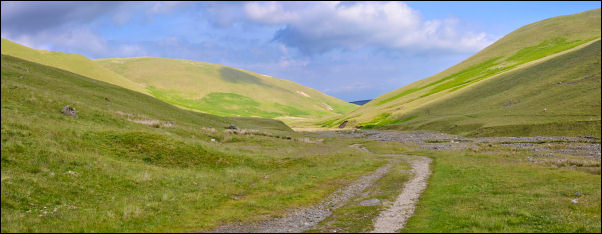
The track follows Dale Beck crossing the beck at a wooden footbridge. It is an impressive view up the valley and the old Roughtongill Lead Mines don’t come in to view until the last bend in the valley. Up ahead can be seen the considerable spoil heaps running up to the base of Iron Crag. The mines were last worked in 1878. It is documented that silver and even gold were found in the area. I crossed the area of spoil waste to investigate a building at the base of the gill. It is quite substantial and in good repair with a steel door. Judging by the water main markers I’d seen on the way up the valley it would appear to be some sort of water intake. I set off up the spoil heap until I came to a grassy slope up to the base of Iron Crag. |
|
It was the ideal spot to stop for a coffee break and sit and take in the view below. I climbed up further between the crag and a deep gorge to reach a gently sloping summit up to a pile of stones. I picked up a faint path heading east towards Great Lingy Hill but left it to take a direct line over the hill towards the Lingy Hut. There were interesting bouldery outcrops and the going underfoot was quite easy. I came to the sheepfold above the hut which had recently been refurbished. As I descended to the hut a party of 6 walkers approached from High Pike and all stopped to mingle around the hut. |
 The sheep fold above Lingy Hut |
 Lingy hut and visitors |
I decided to give my planned visit a miss and joined the path towards High Pike. Before the branch path heads up the pike I kept to the right by the main track as I wnted to investigate the Driggith Mine area. The path passes the wonderfully named Red Covercloth area but I couldn’t see any reason why it has such a name. I left the track to descend towards Driggith Beck and passed a fenced off old shaft. I couldn’t see down it to check how deep it was. After crossing the spoil areas I headed on to West Fell to follow the contour and maintain height while having a good view of the land to the NE. Circling the fell I soon came to the large area of old mine workings at Sandbed. A substantial track then continued past the Dumpy Stone and on the Potts Ghyll Mine area and the main descent track back down to Nether Row. |
|
|
|