|
Kirkland, Meg's Cairn, Melberby
Fell, Green Fell, Cumbria. |
|
|
NY 6452 3256 |
 interesting annex at Bank Hall |
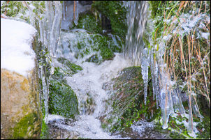 freezing stream above Ousbydale |
The path descended to Ardale beck where I crossed by a wooden bridge. The path marker post had been removed and used to repair a hole in the wall. The map shows the path continuing up the hillside in Lad Slack gully. It is quite steep in places and can’t possibly be the line of the Roman Road. They must have put a kink in the road somewhere to reduce the gradient. At the top of the gully I met the main track up Ladslack Hill which I followed to a gate and ruined stone building. Judging by the surface features it looks as though some sort of quarry workings have gone on in the past. |
|
|
|
|
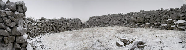
Through the gate the path runs diagonally up the fell and towards the cloud. One of the main advantages of the cold weather is that the ground is frozen hard and the considerable areas of boggy ground were easy to cross and keep my boots dry. At the head of Ousbydale I came to another gate and as the adjacent wall gave some shelter from the cold wind I stopped for a cup off coffee. I continued up the path as far as Meg’s cairn then turned right to head off across open moor and walking on a compass bearing as there was now very low visibility. Everywhere was covered in thin snow but the going was easy because of the frozen ground. I was heading in the direction of Cross Fell and only had my compass to keep me in the right direction. Up ahead I noticed a raised area and a sheepfold. It was quite large and gave good shelter from the wind so I decided to make it my lunch stop. |
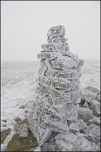 cairn |
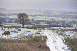 final approach to Kirkland |
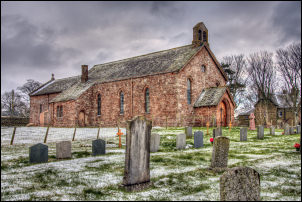
I continued SE across the snowy flats until I came to a discernible quad bike track which I followed the main path to the north of Cross Fell. As the cloud and poor visibility continued I decided to descent by turning right and heading west. There were some fairly recent boot prints in the snow but I didn’t see anybody, even when I descended below the cloud. On the way down I checked out a small stone shelter just off the path. It had a corrugated iron roof but inside was probably only big enough for one person, or two very good friends. The track began to improve considerably, presumably because of the large areas of disused quarry workings in the area. The old workings have some wonderful geographic features associated with them such as Ranscleugh Sike, Plylier’s Gap and Cocklock Scar. The track reached Kirkland Hall which is now converted to holiday homes and seemed to be empty. I reached the car then had a quick look in the adjacent church of St Lawrence. |
|
|
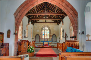 Church of St Lawrence interior |
|
|
|