|
Nenthead, Coalcleaugh, Wellhope
Mines, Nentsberry, Cumbria |
|
|
NY 7810 4365 |
 Hardedge |
|
The track continued upwards and gave good views back towards Alston Moor. I’d been on the track for about a mile when I came to the tarmac minor road connecting Nenthead with West Allendale. I turned left to follow it down to Coalcleugh. On the left were old abandoned mine workings and spoil heaps with the wonderful name of “Rough and Ready”. |
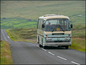 The School bus passing 'Rough and Ready' |
|
I left the road to take the track to the buildings of Sunnyside. The house is well maintained but there was nobody about. The whole area was a collection of old mine workings and spoil heaps. I followed a track, then path west up on to the moor. At the high point I came to a wall and gate but didn’t go though it as my way was to the right. The map shows a public path but there isn’t one where shown. I kept to the wall side then left it for Dodd’s End and the path which was now evident as an old track. It was a lovely walk along the hillside track and I was lucky to have a clear view down in to West Allen Dale and also distant mountains on the horizon. |
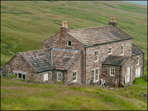 Sunnyside |
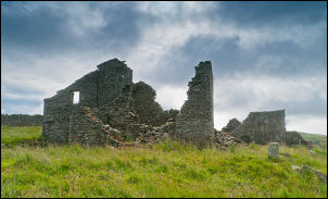
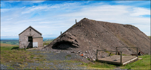 Wellhope Mine and spoil heap - the timber cap of the 127m (416ft) deep shaft can be seen on the right. |
|
|
The map shows a path
going as far as Peter’s Pit mine workings but I took another path to the
left before getting there. As I descended to the Wellhope Burn the path
improved and boards had been fitted in places. I could see the
substantial ruins and spoil heaps of the Wellhope Mine ahead. When I
reached it I was surprised how modern looking the buildings were. They
weren’t stone as I would have expected but concrete blocks. The two
buildings still had tin roofs on and seemed to be used for grouse moor
equipment. The spoil heap was very substantial and standing on the top I
could make out the remains of the old steel gantry that was part of the
original shaft winding gear. Some timber planks covered the head of the
shaft. |
|
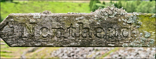 Nenthead - the way to go |
|
|
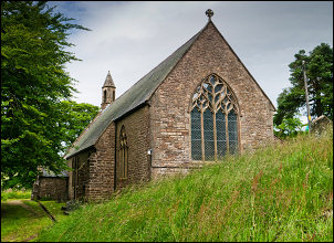
I headed SE along the mine access track to the gate at Hunter’s Break. A van was parked there and looked to belong to someone working on the moor somewhere, possible repairing a fence or wall. Descending to Netsberry there were wonderful views across to Alston Fell and I stopped to examine the view through my binoculars. I could clearly see the route I’d walked a couple of weeks ago. At the road I could have turned left for a easy road walk back to the car but I decided to follow the path down to follow paths through fields a short way above the valley bottom. After Wellgill the path is fenced in near to a wall and is very muddy underfoot. I emerged in to a rough field then through a tiny stile gate onto Church Lane. It was totally overgrown and almost impenetrable. I could see St John’s Church over the wall so crossed a stile gap in the wall to visit the church and leave the overgrown track behind. |
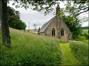 St John’s Church |
|
|
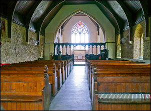 St John’s Church interior |
|
It is England's Highest Parish Church at 440m (1,445ft). The Architect was the Italian Ignatius Bonomi (1787-1870) and it was build very fast, you could say hastily. The foundation stone was laid on 20 Apr 1845 and the church dedicated just 116 days later. I wandered down the main church gate then walked along Hillersdon Terrace, Vicarage Terrace and back to the car. |
 St John’s Church |
|
|
|