|
Howgill Fells, The Calf, Bush
Howe, Cumbria |
|
|
SD 6339 9503 |
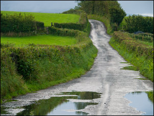 Howgill Lane after the rain |
|
Higher up the track turns left and levels off as it goes round Seat Knott. Approaching Swarth Greave Beck is the wonderful view up the ridge to Bram Rigg Top. I couldn’t see the summit because of low cloud but after negotiating the ford at Bram Rigg Beck the green track heads diagonally up the ridge side to an old sheepfold and on to the summit plateau of Bram Rigg Top. I reached the main summit ridge path and followed it to The Calf. |
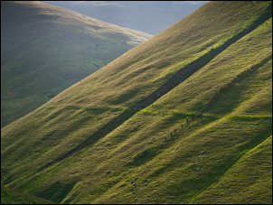 Brief suns rays |
 Ruined sheepfold below Bram Rigg Top |
|
|
The clouds had just lifted enough to give me reasonable views. I took the path to the NW which headed off towards Bush Howe. It’s a good route as there are impressive views all around, especially to the north and the Great Asby Fells. Windscarth Wyke gap lived up to its name with its steep descent and climb up the other side with the wind blowing through. Approaching Linghaw I came to one of my favourite paths in the Howgills. It’s the green track that runs along the west face of Fell Head Scar, crossing Blind Gill on the way. |
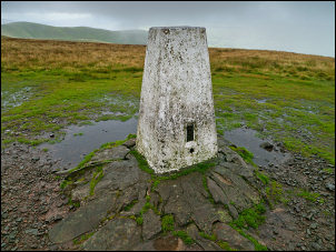 The Calf trig pillar |
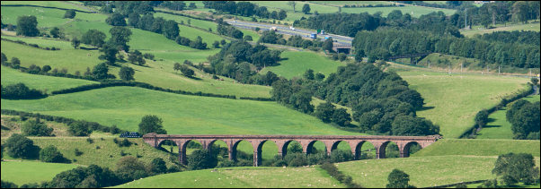 Abandoned Beckfoot Railway Viaduct and the M6 motorway behind |
|
|
The descent is easy but
gets rather wet approaching Beck Houses Gate. The path down to Beck
House Farm is far from straightforward. A path post is stuck in the
ground at the field edge but gives little idea where to go. A gate by
the infant Ellergill Beck is the only clue. It emerges into the farmyard
where the farm access track leads down to the road. After a short bit of
sunshine the rain hit with a vengeance but didn’t last long. About a
1.5mile walk took me back to the car. |
|