|
Blagill (near Alston), Hard Rigg,
Mo Hope, Hesleywell Moor, Cumbria/Northumb. |
|
|
NY 7403 4755 |
 Gatepost seat at Blagillhead |
|
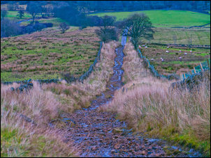
This is an area I’ve not walked in before and I was pleased to see a track heading up on to Newshield Moss which meant that it would be reasonable underfoot. |
 Blagillhead |
|
There was a horribly wet area as I reached the summit gate where I turned NE to follow the wall for a while before going through the next gate and heading out across open moor towards the trig post on Hard Rigg summit. I had to cross the wall to get to it but the wall was in good condition and had plenty of ‘through stones’ to make it easy to step over. I then turned left to head NNW along the wall towards Long Cross. |
 Hard Rigg summit trig post |
|
As I headed slightly downhill the land became very boggy and the bad ground continued all the way to the track at Long Cross. To my left was an area of pine trees with an adjacent area where they’d been felled and cleared. |
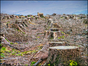 Cleared pine trees |
|
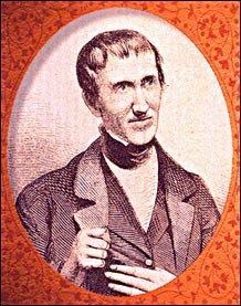
At the track I noticed a small tea advertisement on the gate post. It shows that I was now on ‘Isaac’s Tea Trail’ which is a 37 mile circular trail that commemorates the tea seller and fund raiser Isaac Holden who traded in the area during the 1800s. The gate is also called Long Cross on the map. |
|
|
|
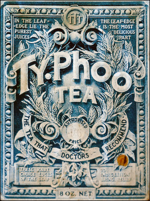 Ty Phoo tea that Doctors recommend. On the Isaac Holden Tea Trail |
 The Billy Tea |
|
|
I turned right to follow the track to the east. I was now on a stoned track which made a pleasant change from soggy bog. At Sandy Ford there was now a culvert to cross the stream then over the summit of Ouston Fell I began the long and very rough descent towards Keirsleywell Row. |
 Gloomy and rough descent of Ouston Fell |
|
The weather continued very overcast and dull but it was just possible to see the distant plains towards Hadrian’s Wall. It was good to reach the tarmac as I turned right to enter the wonderful valley of Mo Hope. On the right I came to the Youth Hostel which is in Orchard House but the YHA calls it Ninebanks. |
 Ninebanks Youth Hostel |
|
I was surprised to see a couple of electric car charging posts outside. |
 Electric charging at the Youth Hostel |
|
The road continued to Redheugh and Nether House where there was a Telephone Call Box which must be one of the most remote in the country and I can’t see many people using it. |
 Telephone call box at Nether House |
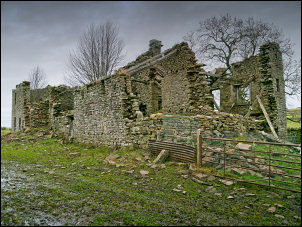
 Ruin of Appletreeshield Chapel |
|
|
Through a gate the path descended steeply down to a footbridge and across Mohope Burn where a large ruined building was in front of me. It was almost at full height and I couldn’t figure out what it could have been. There were no outbuildings so a farm was unlikely. A corn mill would have been sensible because of the close proximity of 2 rivers, but no indication of a leat to run the water wheel. When I got home an internet search found the excellent Fivenine website which revealed that it was the ruin of the Primitive Methodist Appletreeshield Chapel. It was also the first Primitive Methodist chapel in the area, dating from 1829. Over a stile I headed up the hill to the ruins of Appletree Shield which were presumably old farm buildings. |
 Appletree Shield in ruins |
|
A track headed SW up on to the moor towards Halley Moor. It soon became an indistinct path then petered out completely. At Bell’s Moss the moor became incredibly wet and was almost over the tops of my boots in places. I reached the gate a Blacklaw Cross without drowning and thankfully was now on a stoned track. Near Foreshieldgrains I came across a couple of men rebuilding a section of dry stone wall. Just below I returned to a better track where a right branch took me across the fell side back to Blagill. I hadn’t seen a single walker all day. |
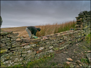 Dry stone wall repairs |
|
|
|
|
|
|