|
Cow Green Reservoir, River Tees,
Meldon Hill, Cumbria / Durham. |
|
|
NY 8108 30920 |
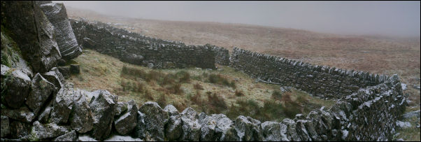
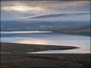 Cow Green Reservoir before the cloud dropped. |
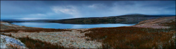 Wide view of Cow Green Reservoir |
|
|
|
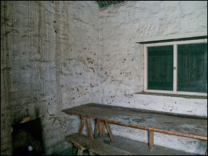 Interior of the hut |
|
My plan was to walk for 2 or 3 miles then cross the River Tees to my left. There are no bridges and I was expecting to have to wade across as I did the last time I was in the area. The track I was on had a thin dusting of snow with some areas having hidden ice underneath. Most of the time I kept to the grassy ridge in the middle. I reached the large area of abandoned mine workings at Green Hurth and set off down the bank through the old spoil heaps. Above High Crag Poole Syke was an interesting stone structure that I though looked like a base for a waterwheel. But with no leat to feed it it must have been something else. I set off across open moor towards the river and found the snow kept balling up under my boots making walking difficult until I could find a stone to break the snowball apart. |
|
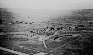
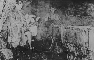 Old photo showing working in the nearby mines. |
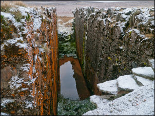 Interesting stone structure |
|
At the river I was surprised how low it was. I’d brought a spare pair of socks and some underfoot liners in preparation for wading across but as it turned out I managed to get to an island in the middle and cross the other side through shallows without the water going over my boots. I didn’t realise it at the time but I’d just crossed the county border from Co Durham into Cumbria. Once on the far bank I walked close to the river where the ground was easier walking. |
 Just after crossing the River Tees I'm in Cumbria and the far bank is Co Durham. |
|
There were a few low waterfalls as I headed downstream. Just before Force Burn joins the Tees I turned right to head up the north bank of the Burn. Ahead were a tall narrow series of waterfalls and a plantation of pine trees. I wonder what the point of the pine trees is. Crossing over the burn I climbed the side of the waterfalls and headed up to where the valley widened. |
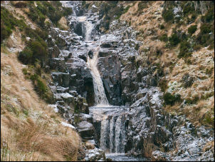 Force Burn waterfalls |
|
This was also where the cloud level started so as I continued up the fell the visibility reduced to a few metres. |
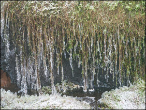 Frozen bog |
 The sheepfold on Meldon Hill |
|
|
I followed a ditch up towards Meldon Hill but before reaching the summit made a short detour to investigate a sheepfold which is shown on the map. The fold has a small shepherd’s shelter at one corner with another a short distance away. I now headed for the summit of Meldon Hill and the trig post. When I got to where it should be I peered through the mist to see the familiar profile of an Ordnance Survey pillar on the horizon. There wasn’t one. All I saw was a pile of rubble and as I got to the location the pillar was in pieces with stones scattered about. The surface plate which holds the portable theodolite was lying on the ground still fixed to the top stone. I found the site very sad and upsetting as it’s the first time I’ve seen one demolished. |
 All that's left of the trig post |
|
I headed east to look for my next objective. The map shows the name Meldon Hall but no associated building so I headed for the co-ordinates I’d previously made a note of. It was a ruin down to ground level but seemed to have been much more than a shepherds hut as some of the stones had been cut and shaped. |
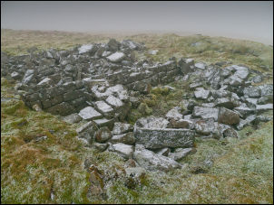 Meldon Hall ruins |
 Old photo of shooting party on the moor |
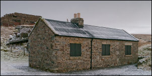
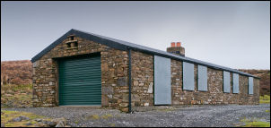 Substantial shooting hut |
|
I started my descent towards the shooting hut to the east. I descended rough moor for a while until I found a line of shooting buts and then a quad bike track which took me to the substantial shooting hut. It looked like it had been rebuilt recently. It was of stone with protective metal sheets over the windows. All access was locked and secured. A stoned track took me down towards the farm at Birkdale and also where the Pennine Way path comes in from High Cup Nick to the west. Birkdale Farm is occupied but doesn’t seem to be doing any farming as there were no animals about. |
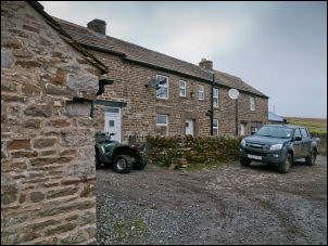 Birkdale Farm |
|
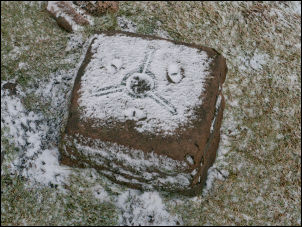
Judging by the quad bike parked by the door it could be part of the shooting estate maintenance. I followed the track to the Cow Green Reservoir dam. At the east end there were recesses in the wall where the descriptive plated for the dam had been fixed. It looked like there had been two but both were missing. Along the road I came to a path to the left which I followed back to the car park. There was an information board that said the reservoir was built between 1967 and 1971 to store water as a compensation reservoir for the River Tees. In dry weather is keeps the River Tees supplied for domestic and industrial use further downstream. |
 River Tees and Cow Green Reservoir dam |
 Cow Green Reservoir dam |
 Reservoir construction in the late 1960s |
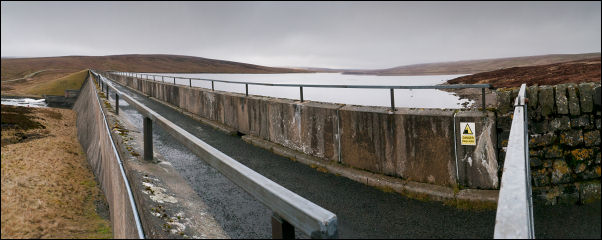 Cow Green Reservoir dam |
|
|
|
|