|
Dead Beck, Bakestall, Skiddaw,
Dodd summit, Cumbria. |
||
|
NY 2360 3099 |
 Access track to Dash Farm |
|
|
It is also part of one version of the Cumbria Way which splits at the northern end of Cumbria, giving a choice of route. The track is also the access road to Dash Farm and on the final approach a minor branch to the right is signposted to Dash Falls. I followed it as far as Dead Beck then took a faint path straight up the hillside towards Dead Crags. There is no path shown on the map but the route I was on had boot prints on it and was fairly easy to follow. |
 Dead Beck mine entrance |
|
|
As the gradient eased I could see the path heading up to Bakestall but I turned off to the right to head for Dead Beck and hopefully the mine. I reached the beck and climbed down the easy slope to the valley bottom. The mine was there at river level and looking inside didn’t have a visible metal grill to prevent entry. On my previous attempts to find it I was standing over it but at a greater height on the other side of the beck. |
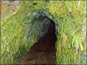 Further into the mine |
|
|
There were still a few snow fields around as I climbed up back to easier gorund. I soon reached a path that I was on last week and followed it up to Bakestall. I continued to the summit of Skiddaw and even though there were still extensive snowfields near the summit the surface wasn’t too steep and was rough enough to walk on with standard boots. I’d only seen a couple of people but over the summit many were coming up from the south. |
 Approaching Skiddaw summit |
|
 Skiddaw summit trig post |
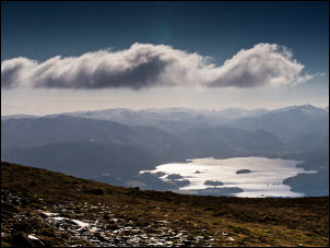 Derwentwater from Skiddaw |
|
|
I took the stony path down to Carl Side then steeply down further to White Stones. I was on the same descent route as last week and I continued on it to the forestry road at Long Doors. I’d never visited Dodd summit so took the sign posted track up the hillside and followed it all the way to the summit. There I found a slate stone mounted as a vertical pillar with various metal plates fixed and showing memorial messages.
|
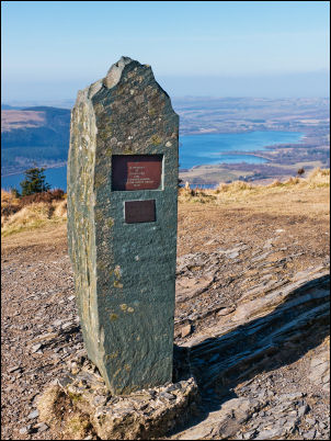 Memorial stone on Dodd summit |
|
|
There wasn’t a continuing descent path on the map but I could see a minor path on the ground. I followed down to the north through an area of old tree roots and scrub. It wasn’t enjoyable but eventually I came to an old forestry track which I followed to the right to join the main forestry track by Skill Beck. |
 Hazy view of Bassenthwaite Lake form Dodd |
|
|
On the final approach to the Old Sawmill Tearoom the path isn’t marked at all and I finished on a very minor path down to the tearoom. There were a few people around and cars parked. I now had the road to follow back to the car but fortunately for the first part of the route a path runs parallel to the road. After the Ravenstone Hotel I was back on the road but thankfully not for too long before reaching the car. |
 Old Sawmill Tearoom |
|
|
|
||