|
A894, Quinag, Scottish
Highlands. |
|
|
OS Grid Ref: NC 2328 2737 |
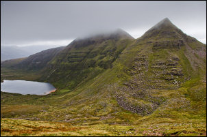
 Up into the gloom |
|
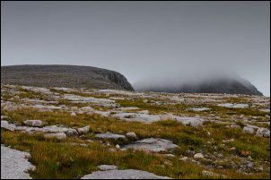
I crossed a small burn by a footbridge then followed a good path up to the west. The main summit is Sail Gharbh but I wanted to cover the three summits. I came to a cairn which marks were a branch path heads south across stone slabs. The path was less distinct but still easy to follow. Then I started the main climb towards Quinag. Because of the low cloud I couldn’t see far ahead and it’s maybe as well because of the distance I’d need to cover. As steep rock walls seemed to present a problem they turned out to be straightforward as a faint path was always available. Before the first summit I came to a stone windbreak with a misty view of Loch Assynt behind. |
 Loch Assynt in the distance |
|
The summit called Quinag on the map is one of the lower peaks. After ups and downs I came to a sharp ridge which I imagined would be spectacular in clear weather. I got the occasional glimpse of the distant land below as the cloud occasionally parted. |
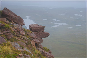 From Quinag |
|
I reached the northernmost summit of Sail Gorm then had to turn round and retrace my steps. The temperature had dropped to 2 deg C (see temperature plot on map page) but the wind was surprisingly light so it didn’t feel too cold while walking. I’d heading back south for about a mile when I found the branch path to the east and the highest summit of Sail Ghabh. Even though I had no views the walk across the flat stone slabs was extremely enjoyable. The summit was a trig post surrounded by a stone wall. |
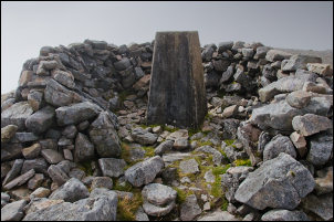 Trig post surrounded by a stone wall |
|
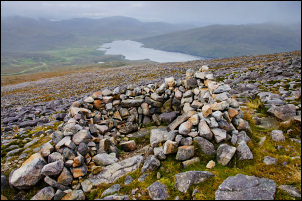
I’d reached 808m and once again had to turn round a retrace my steps, though not as far this time. I started down a steep diagonal path that was in good condition and didn’t present any problems. I also saw the first people of the day as a couple of walkers were coming up. I could see Lochan Bealach Cornaidh below but the path didn’t go anywhere near it. The flat area the path crossed was wet in places but easy to follow. Several more people were coming up as I continued down. Eventually I reached the cairn that marked where I’d taken the branch during the early part of the walk. A short easy descent took me back to the car park where there were quite a few more cars that earlier. |
 On the descent |