|
Bowlees, Newbiggin,
Middleton-in-Teesdale, Monks Moor, Hardberry Hill, Co Durham. |
|
|
OS Grid Ref: NY 9078 2828 |
 Newbiggin Chapel 1759 |
|
The path across fields to Hud Gill was very wet. After that I followed the line of an old track up the field and onto the tarmac road at Newbiggin. It was a pleasant walk along Miry Lane and up the steep climb to the higher length of road that took me to Middleton-in-Teesdale. |
 Heading towards Middleton-in-Teesdale |
|
|
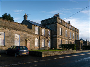
 Town centre |
|
When I reached Market Place it started to rain but it soon stopped. I
left the town up a lane heading north. Part way up was a stone shelter
building by the road. It looked like a bus shelter but wasn’t. Inside
was a memorial plaque that read: |
 Addison memorial shelter |
|
|
 Hut by sheepfold |
|
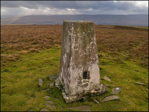
I turned right at the top of the hill then followed the road to Blunt House where I turned left into the field to follow the path towards the hills. It was very wet as I squelched my way upwards towards Monk’s Moor. To my left I saw a small stone hut which I investigated then further up I left the path to cross rough moor to the trig post on Monk’s Moor. |
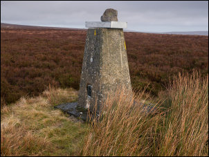 Trig post on Monk's Moor |
|
There was no sign of a path anywhere so I had to find the best route I could through the heather. I left to the NW and headed towards a large protruding rock I could see in the distance. The map shows it as a Currick. After checking it out I descended to the west where I saw some strange stone features by my route. |
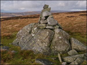 Currick |
|
|
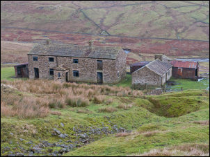 Coldberry Mine buildings |
|
They were
rectangular stone edged features that looked man made. I continued down
to the road which I followed north then west to cross Huddshope Beck. I
climbed up through a large area of old mine workings. Higher up some of
the buildings were substantial and intact. The map calls it Coldberry
Mine. An internet search showed it was last used in 1933 and two deaths
were recorded. |
 Trig post on Hardberry Hill |
|
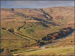
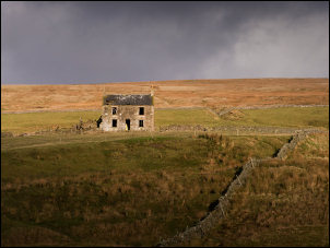
There were no path markers as I descended towards Laddiegill Sike. There was a lot of evidence of old workings in the landscape. The lonely Red Grooves House stood out against the landscape. It looked empty and derelict but not yet ruinous. Across wet fields I crossed the road to more wet fields. |
 Red Grooves House |
|
The path stile at one point had been blocked by corrugated iron but I managed to get through. The path continued to Flushimere Beck but there it ended without a bridge. To get across I had to take my boots off and wade. Next came Wester Beck which wasn’t quite as big and I managed to jump across. There was a steep climb up to the path above Bow Lee Beck. Thankfully I was now on a proper path and hoped to find Gibson’s Cave which the map seems to show on the west side of the river. I walked through the woods all the way back to the car park and visitors centre, which was closed. |
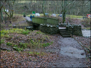 Footbridge by the visitor centre |
|
|
|
|
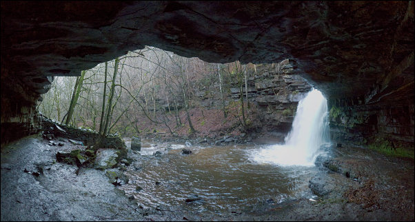
I took another path up the east side but there were no
markers as to where the path leads to. I kept going till I came to a
sign saying I’d reached Gibson's Cave and Summerhill Force. |
|