|
Castercliff Hill Fort, Walton's
Monument, Southfield Church, Nelson, Lancs. |
|
|
OS Grid Ref: SD 8819 3723 |
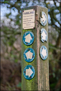 You can have too many markers |
|
It was quite wet as I
descended to the school. I turned right along a track as far as Little
Gib Hill buildings then right again onto a muddy path. I was now
approaching my fist objective of the day. I wanted to see Castercliff
hill fort site. I walked up to the summit area to see many humps and
bumps but not much to indicate a fort. It has to be seen from the air to
get a full impression. |
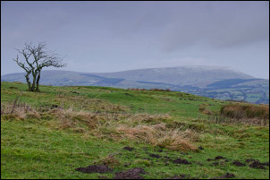 Looking across the fort site to Pendle Hill |
|
I descended and rejoined Southfield Lane for a short while before heading up Back Lane to my next objective. Over a gate and up a muddy field I came to a large stone protruding in isolation. It is known locally as the ‘altar stone’ or ‘anvil stone’ there were no markings on it. |
 Back Lane |
|
Then I continued to Walton’s Monument which is a tall stone spire with crossed stones on the summit. The carved date high up is 1835 though the base is supposed to be 9th century and possibly a marker for the 'Battle of Brunanburh which was supposed to have been fought close-by in AD 924. There has never been any evidence to define its location as many places have claimed it. |
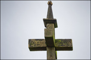 Top of Walton's Monumnet |
|
The spire was erected by
the Rev’d R.T.Wroe-Walton of nearby Marsden Hall between 1830-40. |
 Trig post and Walton's Monument |
 The way to go |
|
|
I began to look for somewhere to eat my sandwiches but there was no shelter from the wind. I continued down Sheffield Lane to the cross road then straight across to the rutted and very muddy Crawshaw Lane. I had my butty break here behind a wall and out of the wind. I continued to Catlow House then across Southfield Lane and down another track. |
 Narrow path between walls |
|
This was in better condition. I wasn’t on it long before turning right and following a path between walls then out into open fields. The map here is completely wrong as it shows the path going straight on. Around the field I went through a narrow wooden gate then a grassy path to Southfield Fold. I had a look at the Southfield Methodist Church but couldn’t make out if it was still used for worship or was used for farm buildings. |
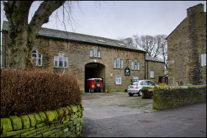 Southfield Methodist Church |
|
A date stone over the door said ‘W & E Sagar 1797’ and a stone plaque on the wall said ‘John Wesley preached here April 18th 1786’ so John Wesley must have preached before the church was built. The sign said Sunday service at 11am. It was just past that time and no service was underway. |
 John Wesley preached here |
|
I asked the farmer nearby and he told me they’d stopped services in January because sometimes they have access problems. The church is still going and uses and upstairs room. From there I had a short walk up the track back to my car. |
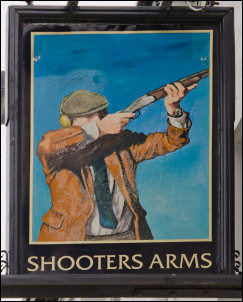 Shooters Arms |
|
|
|