|
Walden, Walden Head, Buckden
Pike, North Yorkshire. |
|
|
OS Grid Ref: SE 0042 8268 |
 Dismal start to the walk |
|
The weather was overcast and very dull. The track was easy going up to Wild Gath where there was an old limekiln by the track which looked more like an old mine addit. The track levelled off but was far from easy walking as the stoned surface was covered in ice. Most of the way I had to keep to the grass on the track side. For a while I had a gloomy view down into the valley bottom but I was soon in low cloud and lost the view. |
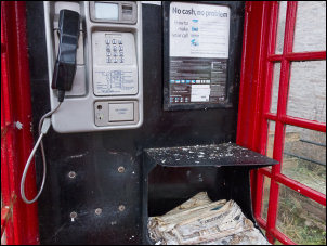 a very scruffy phone box |
 Valley view from Wild Gath track |
|
|
Up a side track was a shooting box, or more accurately a shooting house. I decided to investigate as it was the only place I was likely to find some shelter to have my sandwiches. When I got there I was impressed how tidy it was and even better it was unlocked. Inside was very clean and tidy and even though it was still early I took the opportunity to have a comfortable lunch. I descended back to the main track and had to take care on the icy descent. |
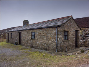 Shooting hut near Wind Egg |
|
|
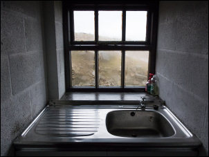 Kitchen sink |
|
The map calls the area Wind Egg and I was walking up the side of Willy’s Gill. The track soon petered out and I was heading across open moor. The temperature was -4degC so the ground was frozen hard making the going much easier. |
 Buckden Pike summit |
|
I reached a fence, turned left and followed it. It would take me to Buckden Pike summit but there was no path of any kind. With a mix of rough ground and frozen snow patches it was difficult going. Snow started to fall and the wind made it sting my face. |
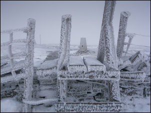
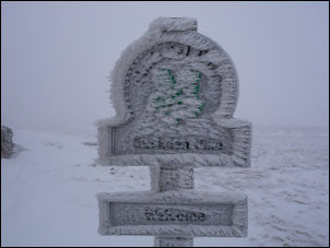 frozen sign |
|
Towards the summit the fence ended and a wall took over. At the top a frozen stile took me to the Buckden Pike trig post. Everything was covered in ice so I didn’t hang around. Continuing south I came to the memorial for a crashed plane. It was a Wellington Bomber that crashed on a training flight on 30 Jan 1942. There was only one survivor, Sergeant Joe Fusniak. There was little to see in the thick and freezing cloud so I continued down to the 1810 marker stone. |
 Crash memorial |
|
I turned left through the Hard Rake Quarries area where several piles of stone can be seen. The map shows a path continuing but there is nothing on the ground. The line of the path is very vague on the map and couldn’t find any sign of it. I headed down Fosse Gill below Walden Moor and skirted round the contour line to eventually find the path above Deepdale Gill. I reached the valley bottom at Walden beck but once again the path on the map is completely wrong. The first proper path sign I saw was on the opposite side of the river. I followed it through boggy fields to eventually reach a bridge then a track to Kentucky House. I was now on the tarmac adopted road at Temple Lane but the snow was making is slippery going. It was only a thin layer of slush but kept building up on the soles of my boots. It was a wet walk back to the car. |
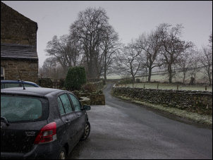 A wet Temple Lane |
|
|
|
