|
Murton, Murton Pike, High Cup
Nick, Cumbria.
[13.4 km]
Wed 26 Mar 2014 |
|
|
|
OS Grid Ref: NY 72980
21986
Lat/Long: +54.592330, -02.419668
The mornings are much lighter now and the sun was already up as I
approached Tebay on the M6. It was cold at -1degC and fairly clear as I
reached the village of Murton, Near Appleby-in-Westmoreland. Although
I’ve passed through Murton I’ve never visited the car park which is at
the end of a lane to the NE. The strange thing is the car park is quite
substantial with information boards but isn’t shown on the map. It’s
also free. |
|
|
|
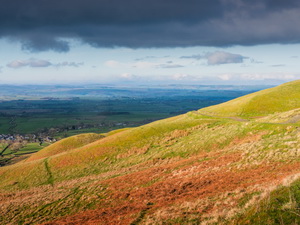
On the
approach to Murton Pike |
|
|
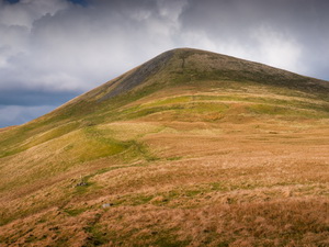
There are two tracks
leaving the area and fortunately I was taking the one up Murton Pike.
The other, to the right, headed east into the Military training area and
had a red flag flying. This indicated no access. I set off up a well
made track which heads up the south end of Murton Pike. The summit of
the Pike is quite steep but the track took a wavy line up the gentler
southern slope. I passed through some wonderfully named areas shown on
the map. |
|
|
|
View
towards the Cumbrian fells |
|
|
The first was Sweety Briggs then Cringley Hole. I passed under Merton Crag but
couldn’t see the Pike as it was hidden behind. Then I left the track to
take my own route steeply up towards the summit. The land flattened out
for a while then steeply up for the last bit to the summit trig post. |
|
|
I’d been sheltered from
the increasing cold east wind on the way up but over the top I was hit
by its icy blast. It was still 0 degC so felt quite cold. I started my
descent to the east to re-join the track. I was surprised to see a faint
path and on the way a path marker post. When I got back to the track
there was another. My map doesn’t show any path going over the summit of
the pike. The track continued steadily upwards through mixed ground and
stony area. |
|
|
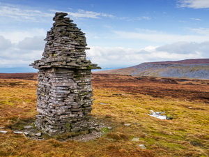
I visited a tall cairn or
currick and several stone wind shelters before following a faint track
over rough ground. I soon realised I was heading nowhere and returned to
the official path which was still indicated with marker posts. The path
continued towards High Cup Nick, my next objective, but I soon saw a
large currick on higher ground to my right. I couldn’t resist heading
for it even though there was no path. I followed the side of a stream
until the ground levelled and soon reached the impressive tall cairn. |
|
|
It was unusual as it had
a stone shelf of protruding slabs below its top. Nearby was another
cairn but with a shelter seat inside. I headed down across rough ground
back to my High Cup Nick objective. On the way I and a look at an old
campsite I’d used and the stones were still there that I put my gas
stove on. |
|
|

High Cup Nick |
|
Steeply down I reached
the path along the south side of the High Cup Nick valley. It was a very
impressive walk though I had to take care near the edge as the wind was
now blowing quite strong. Hidden in a small side valley was a
substantial ruin which looked more than just a shepherd’s shelter. |
|
|
The path continued quite
distinct down Middle Tongue towards Harbour Flatt. Above Trundale Gill I
had to take a steep descent with no path to cross the river and join the
official path on the other side. It’s an odd place for a path as it
doesn’t go anywhere. Below me were two men rebuilding the stone wall but
they were too far away to go over and have a look. The path improved to
an old green track and then I saw my first and only walker of the day, a
woman and her dog. The path was intermittent and at Trough Keld was a
mass of reeds. It soon improved on the final approach back to the car
park. |
|
|
|
|
|
|
|
|
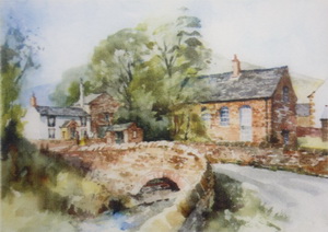
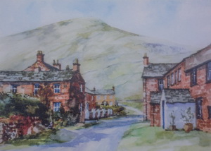
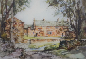
Some lovely illustrations of local scenes
on the information board by the Merton bus shelter. |
|
|