|
Reeth, Arkle Beck, Hurst Mine
Workings, Marrick Moor, North Yorkshire.
[17.5 km]
Wed 01 Oct 2014 |
|
|
|
OS Grid Ref: SE 03814
99291
Lat/Long: +54.389086, -01.942776
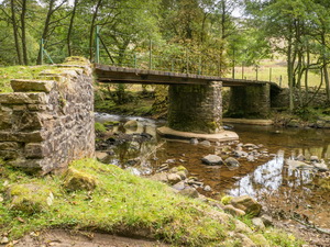
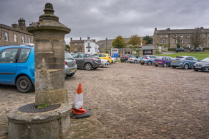
My walk started from the village square in
Reeth. The parking is by donation and as they suggest £1/day or 50p/half
day it’s a reasonable amount to pay. I’d driven there via the Tan Hill
road and started by walking back the way I’d come for about a mile until
I left the road and followed a track down to Arkle Beck. The bridge is
surrounded lovely woods but a sign says no footpath access upstream. |
|
|
|
|
|
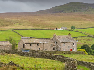
I followed up between
stone walls to a higher path on the hillside. I joined it via a ladder
stile but on the other side a sign said ‘no path’ the way I’d come. Too
late. I was now on a nice path with great views heading NW and parallel
to a wall on my left. Up ahead I would need to turn right near a
building called Heggs House. I could see the stone building below but no
sign of a path above. The building looked as though someone was doing it
up but hadn’t done any work in a while. |
|
|
Nobody was about. I set
off up the steep hill, partly through ferns and scrub. I climbed a
barbed wire fence where the path should be then noticed a stile further
to the west. After a flat area I followed an old miner’s track up to the
Fell End Lead Mine area and found the main path. |
|
|
|
Lovely
path below Fremington Edge |
|
|
|
|
View
south from Fremington Edge |
|
|
|
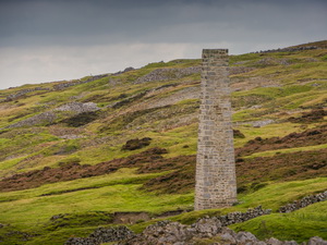
Through a gate the track
improved considerable through extremely substantial old workings. For
almost a mile the whole area was spoil heaps and old excavations. At
Hall Farm I made the first of two detours to old chimneys. The first was
square in section and in good condition. It is known as the Brown Shaft
Chimney. |
|
|
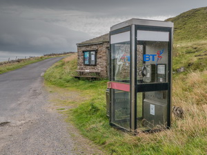
The second was round in
section and the Cat Shaft Chimney. Both had been refurbished and pointed
though neither had a base level access. The area is called Hurst and
there’s even a phone box and notice board. I turned right and continued
along the road to Ings Head where I climbed over a path gap in the wall
to the right. |
|
|
There was no sign of the
path but I headed off in the direction where it should be and eventually
found it. Over the hill I was heading for Owlands Farm but couldn’t see
it. As I headed down to the valley its roof appeared in front of me. I
walked through the farm to sounds of barking dogs both inside the
farmhouse and outside in the yard. But there was nobody about. |
|
|
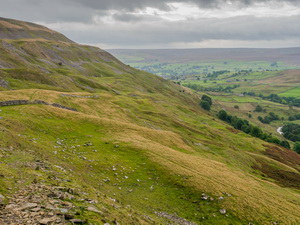
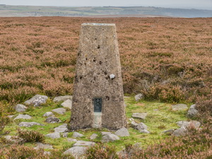
A track took me over
Raygill Allotment where I joined the main track along Fremington Edge. I
headed SE for a while then set off across rough and featureless moor to
check out the O.S. trig post in an area that doesn’t even have a name.
And it’s not even on the highest point either. Objective achieved I
crossed more rough ground back to the track. As I descended to the road
at New Close Bank I met my first and only walkers of the day, a couple
coming up the hill. |
|
|
|
Trig
Post on Copperthwaite Allotment |
|
|
At the road I descended
steeply down Reels Head towards Low Fremington. I had a feeling of Déjà
vu as I walked along. The last time I was here was walking the Coast to
Coast route with Charlie. |
|
|
I still have the
Wainwright book of the walk and the time schedules on the back pages.
The last time here was Sat 17 May 1980. Over 34 years ago. In Low
Fremington I joined the main B6270 where the Tour de France passed back
in July. Over the bridge and I was back in Reeth. |
|
|
|