|
Stanhope, Stanhope Burn,
Parkhead Station, Collier Law, Fatherley Hill, Crawley Edge, Co Durham.
[19.5 km]
Wed 02 Aug 2015 |
|
|
|
OS Grid Ref: NY 99347
40787
Lat/Long: 56.911405, -02.910297
After a pleasant drive via the M6, A66,
Barnard Castle, B6278 I reached Stanhope then drove up the steep hill to
the north to a large parking area by the road at Crawleyside Bank. I
headed west along a farm track then joined the path north by the wall to
Heathery Burn. Across the burn I turned left at a track then downhill
towards the Fluorspar Mine area in the valley bottom. |
|
|
|
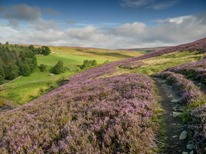
Near the
Fluorspar Mine area |
|
|
Before reaching it I took
a path to the north, past a large stone hush gulley and along the valley
side. The map shows the path crossing the river at a ford and as the
river was relatively low I could have crossed. I decided to stay on the
same side as I would have had to cross the river again. |
|
|
|
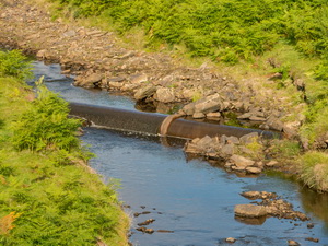
Large
(900mm?) pipeline in the river |
|
|
There was no path but it
was easy underfoot. On Whiteley Rigg I turned right to follow a very
indistinct path up the hill towards Wilkinson’s Cut. Near the top the
path vanished and I had to find the best route I could. I reached
Wilkinson’s Cut, which is now a cycle track on the route of an old
railway that used to service the mines. |
|
|
I turned right to follow
it to the road. I was on an embankment and originally the road went
under a bridge, which is now long gone. Across the road I returned to
the top of the embankment for a while then down to a group of buildings
called Parkhead Station. This used to be a railway station but that went
with the railway. |
|
|
|
|
|
|
|
The main house was quite
well maintained but I didn’t see anyone around. I headed south through
the Dursand Quarry area and joined a track to Collier Law where the map
shows a radio mast. |
|
|
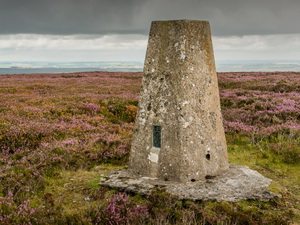
There was no sign of a
mast now so after checking out the trig post over the fence I continued
south along the east side of the fence. It was wet and boggy underfoot
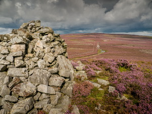
to Fatherley Hill and the currick. |
|
|
There was now a vehicle
track and I could see what looked like grouse beaters to the east. As I
walked a couple of land rovers drove by carrying the beaters in the
back. |
|
|
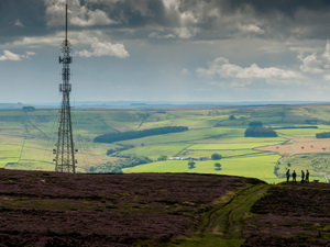
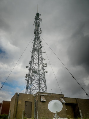
They stopped near the
radio mast at Rogerley Plantaion, got out and the vehicles returned the
way they’d come. I continued down the track then road to the main A689. |
|
|
|
|
|
|
|
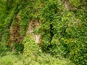
Stone
chambers behind the ivy |
|
|
I had to follow this for
a while which wasn’t nice due to lots of traffic. Across the road I
noticed an interesting dry stone structure of three chambers almost
covered in ivy. They weren’t kilns so I have no idea what they could be
other than a folly. I reached Shittlehope and thankfully left the road.
The path route has been diverted round a group of new buildings then I
re-joined it by the bank of Shittlehope Burn. It had started to rain
hard so I was thankful of the dense tree cover above. |
|
|
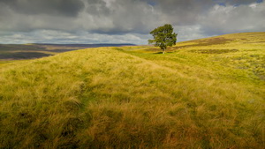
I crossed the Burn by the
footbridge then up a steep bank to Jollybody Farm. The map shows a cave
by the burn but I missed it. I then followed a pleasant track above
Crawley Edge where I stopped for a while to take in the views of the
large patterned spoil heaps below. Then it started raining again so I
began to speed up on the final stretch back to the road, car park and my
car. |
|
|
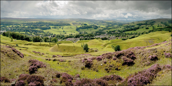
View from Crawley Edge |
|
|