|
Tunstall Reservoir, Wolsingham
North Moor, A68, old railway, Co Durham.
[15.7 km]
Wed 30 Sep 2015 |
|
|
|
OS Grid Ref: NZ 06417
41349
Lat/Long: 54.767031, -01.901788
My drive to Co Durham was
sunny at first but soon I was in mist and fog. Driving along the A689 I
reached Wolsingham then turned north along the cul-de-sac road to
Tunstall
Reservoir and a car park in a wooded area. The reservoir was opened
in 1879 as a water supply reservoir but is now only used to provide
compensation water to the river below. |
|
|
It was the first location
where cement pressure grouting was used.
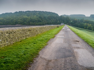
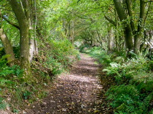
I walked back south along the road then along the track across the top
of the reservoir embankment. Some work was being done at the far end.
The track continued steeply up through Blackstone Bank Wood to the farm
and houses at Blackstone Bank. |
|
|
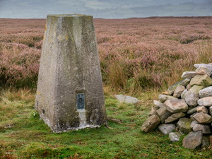
It was still hazy with
mist so my view down the valley was limited. A rougher track continued
straight up the hillside to a gate where I turned right to follow a
level path heading towards an area of heather. I was on another rough
track which I left for a while to have a look at the trig post. |
|
|
|
|
|
As I stated to descend Thistlewood Lane the weather improved a bit and I was able to see some
sunshine.
At Thistlewood Farm I reached the tarmac road but soon turned
left up a narrow track which originally was the access to a quarry area.
At the top I followed a path across open fields and Dodd Hill to
Wolsingham North Moor. |
|
|
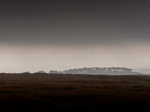
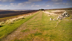
It was open and flat with
wind turbines in the distance. I turned right and followed a track by
Castle Hills to the road at Sandy Carr. I reached the B6296 and had to
endure busy traffic for over a mile. I reached the main A68 where the
traffic was even worse and much faster. It was a relief to reach the
Greenfield Cottage area where I turned left on to a track that followed
the line of the old railway. |
|
|
|
|
|
|
Further
along the railway |
|
|
The rail line originated from 1845 but has been disused for
many decades. The map shows the path running along the side but the rail
route is a perfect route for walking. I now had much better weather and
views and surprisingly good mobile data reception for my phone. I was
able to post a picture to Facebook. After a mile the rail line was gated
off and overgrown. The path continued by a wall which I followed to a
gate and a farm track that descended down the hill, through the woods
and back to Tunstall Reservoir. I found a narrow path running by the
reservoir which took me back to the road and then the car park. There
were many memorial bench seats around the reservoir with name plates to
commemorate people. The water authority had placed notices on them
asking people to register the seats and provide details. It was now a
nice sunny day and I had a sunny drive home. |
|
|
|
North
end of Tunstall Reservoir. |
|
|
|