|
Dunmail Raise, Dollywagon Pike,
Helvellyn, Birk Side, Wythburn Church, A591 road
slip, Cumbria |
|
|
OS Grid ref:
NY 32957 11158 Lat/Long: 54.491306, -03.036510 I knew the A591 north of Dunmail Raise was closed due to road subsidence where the river had washed it away. I wanted to try a walk over Dollywagon Pike to Helvellyn. I wasn't sure where the road was closed so set off through Windermere and Grasmere along the A591 to try and get to Dunmail raise summit. There were barriers across the road north of Grasmere but it was easy to get by and I was able to reach the lay-by car park on the summit without problems. I set off in sub zero and snowy conditions to head up Raise Beck. The climb was steady and much easier than I expected. |
 The deserted A591 at Dunmail Raise |
| There was still cloud around and when I reached Grisedale Tarn I could only just see the track heading across to the east. The zigzag path up Dollywagon Pike was totally obscured by snow but it was in good condition and ideal for step kicking. As I reached the summit of Dollywagon Pike the trail levelled off but the going was still tough at times through the snow. I was able to get a view down Grizedale and managed a couple of photos. I continued over Nethermost Pike and then could see Striding Edge to my right. As I climbed up towards Helvellyn I entered cloud so I had no view until I reached the stone shelter. |
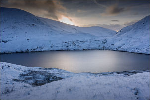 Grisedale Tarn |
 Grisedale Hause |
 Boundary post on Dollywagon Pike |
| Then I saw two walkers approaching from the other direction. They headed for the shelter while I set off to the summit trig post. I was lucky to get a good view for only about 10 minutes before the clouds rolled back in. I returned to the shelter to have my sandwiches and chat to the other walkers. We all left to head off back on our own separate ways. |
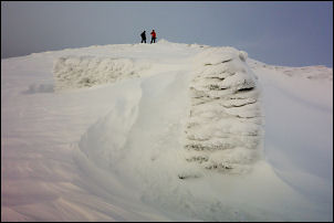 Summit shelter on Helvellyn |
 Stone wind shelter on Helvellyn. Temperature -6degC |
|
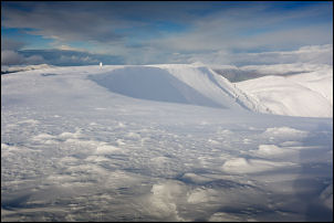 Helvellyn and trig post in the distance |
 Repairs on the A591 |
| I descended to the south but then headed down the path via Birkside. The path was mostly obliterated as it was covered by the snow. The Descent was quite tricky in places due to deep snow. Where they path had been stoned below Birkside I had to put my ice studs on because of very slippery conditions. As I descended I could see evidence of flood damage and parts of the path had been washed away. When I got into the forest and the forest track the path running along it had been closed. | |
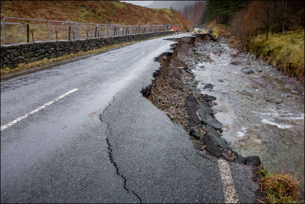 The A591 where it washed away by the Dec 2015 floods |
|
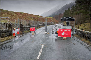 Closed A591 were the river has washed it away |
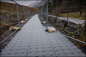 Mollie's path. A temporary bypass for shoolchildren |
|
I descended the path down to Witburn church and joined the A591
road which was closed along this length due to flood damage. A machine
was working just north along the road but my way was south, heading
back to Dunmail Raise. As I approached the Stockhow Bridge junction
there was a high metal barrier completely across the road. A man in a
cabin came out and let me through but said the continuing road was
closed. I knew that because of the road subsidence so I took the
forest track on a higher line. I was able to step across the river and
visit the site of the flood damage where they road had been completely
washed away. They road area was bariered off but not from the river.
After taking a few pictures I headed south back along the main A591
road to the car on Dunmail Raise.
|
|