|
North Stainmore, Stainmore
Common, Great Knipe, Cumbria. |
|
|
OS Grid ref:
NY 82961 15177 Lat/Long: 54.531559, -2.264816 I had a dark and rainy drive north along the M6 then left it at Tebay and continued to Brough. A few miles along the A66 to the east I turned off at North Stainmore where a narrow road runs up onto the moors. The first part of this is the old original road and I passed a very large house which used to be the Punchbowl Inn. |
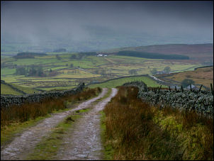 Lane up onto the moors |
|
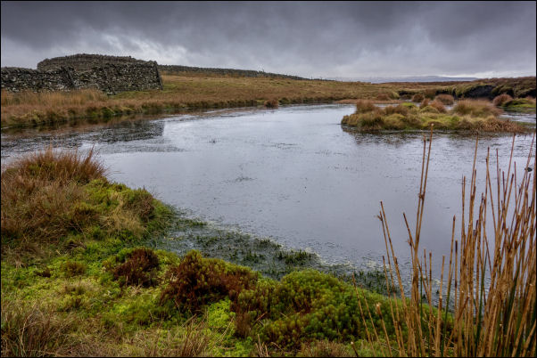
It is very dilapidated now. I drove north up the lane and parked outside the Village Hall. I set off in light drizzle but as I continued up the lane the rain stopped. At the end of the adopted Road I went through a gate to follow an unsurfaced track to the remote Farm of Long Craig. |
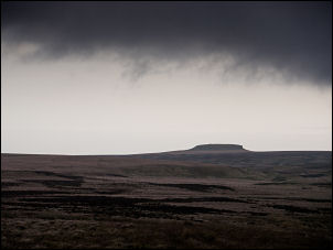 Distant view of Goldsborough |
| In distance and in the direction of Warcop Moors to the west was the constant sound of machine gun fire from the military ranges. After this the track continued onto the open moor and became progressively worse and very wet. Even though I was on a bridal way there was no path evident. At a place called Round Hill on the map at Balder Beck I crossed the stream and headed slightly uphill to a stile and old boundary post. |
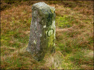 Old boundary post |
| The inscription on one side seemed to read N 10. I was on the border between Cumbria and Durham but stayed on the Cumbria side. I following the path and left it by turning south to head along Round Hill Syke where I soon came to an old stone sheep shelter. It was windy so I used the shelter to have my sandwiches. |
 Summit of Round Hill Syke |
| As I continue up Round Hill Sike I was fortunate that there were shooting butts and a faint quad bike track which I followed to the high point and a boundary wall. At the summit was another sheep shelter and ruined building connected to it. |
 Ruin by sheep shelter |
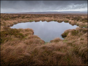
 Small tarn on Great Knipe |
|
| I continued following the wall in a southeast direction and luckily the going was fairly good underfoot. I followed another quad bike track but had to leave it and head back to the wall where conditions were extremely wet and muddy. In the distance I could see my next objective, the trig post on Little Knipe summit. |
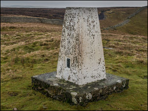 Great Knipe trig post |
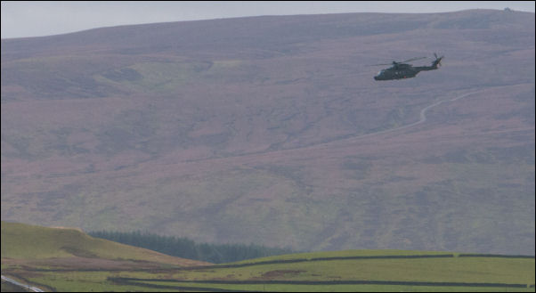 Manoeuvres from Great Knipe |
|
| Fortunately for me a section of wall had collapsed and I was able to get through and reach the trig post without problems. It was an extremely good viewpoint with the A66 road below. Distant cloud prevented far distant views. I wasn't sure of the best route to take for my descent as it was a steep descent and I could see that the area of great Moss below was going to be very difficult to get through. |
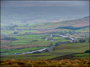 A66 from Great Knipe |
|
I
decided to descend along the hillside in a northwest directions to
keep above the wet ground. I reached Smeltmill Beck which I cross easily and followed it down to the track which I followed down from the moors. I continued along the unsurfaced track to Slapestone Bridge where I left the road to cross under the A66 by a track through a tunnel. |
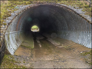 A66 underpass |
| Down a path I reach the farm track for Light Trees Farm and turned right to follow it to reach the road at Penistone Green. This was part of the original road before the A66 was built. I reached the A66 and crossed it to re-join the old road and back to the large house that used to be the Punchbowl Inn. It was then a short walk back to the car. |
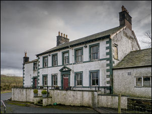 Formerly the Punchbowl |
|
|
|