|
Heron Pike, Sheffield Pike,
Glencoyne, Cumbria. |
|
|
OS Grid ref:
NY 38734 18428 Lat/Long: 54.557363, -02.948844 To the north of Glenridding on the A592 is the access track to Seldom Seen cottages. There is also a small parking area which is where I left my car to start the walk. I followed the path to the south and above the shore of Ullswater. The scary thing is there is still debris marking the high point of the Dec 2015 floods and it must be about 4m higher than the existing lake level. |
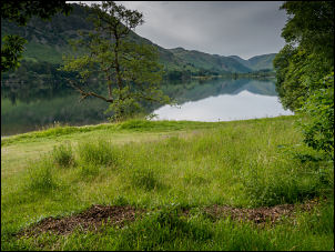 High water mark in the foreground |
| At Mossdale Beck there is a large fenced off estate house but after it a minor path climbs up the south side of the beck. There is also a lay bye at the road where it starts. It is shown on the map but there is no marker post. I started climbing through dense woodland and in places high ferns. |
 Looking down on Ullswater |
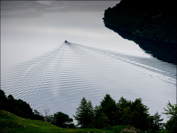 Ullswater |
|
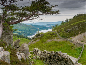
| Although little used the path is easy to follow and gives better views the higher I got. Eventually the track levelled off at a boggy area to the north of Glenridding Dodd and a short way on the ground improved to a gate in a wall. It was a collapsed gate and marked the junction of paths. I turned right to follow a route which climbed steadily to Heron Pike then across a flat area to the final climb to Sheffield Pike. |
 Looking towards Catstye Cam & Helvellyn |
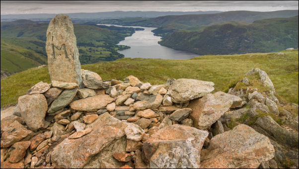 Sheffield Pike looking towards Ullswater |
|
 Sheffield Pike today |
 Sheffield Pike & son Steve Jan 2003 |
| I was here is Jan 2003 with my son Steve but then it was covered in snow, though not too deep. It was overcast but still had excellent views. Although I could see Helvellyn above Catstye Cam I thought the best view was the other way looking along the length of Ullswater. I hadn’t seen anyone so far but as I descended to the west I met a man coming up. We exchanged a few words about how cold it felt. I reached Nick Head and walked straight across then uphill to join the path that follows around the head of Glencoyne. I reached the Glencoyne mine entrance where I went on an underground trip many decades ago with the Red Rose Caving Club. |
 Glencoyne Mine entrance |
| I continued to a small grassy promontory where I was forced the camp for two days in Oct 2008 while being battered by ferocious rainstorms. My tent poles were bent and damaged after the storm. I continued east to a point above an old collapsed dam I could see below on Glencoyne Beck. I descended the slope to investigate but couldn’t see what it may have been used for. Across the beck I joined the main path above Seldom Seen and followed it down to the gate where I took the lower path to descend to Glencoyne Farm and it’s amazing chimney stacks. It is a grade II listed building and has a plaster panel inside dated 1629. I spoke to a lady who was working in one of the buildings and asked her about the dam further up the valley. She didn’t know anything about it and said several people had done historical surveys up there but nobody had any information. I followed the farm track back to the main road and the short length of path back to the car. |
 Waterfall on With Burn |
 Seldom Seen cottages |
 Glencoyne Farm |
|
|
|