|
Melmerby, Melmerby Fell, Megs
Cairn, Hartside, Gamblesby, Cumbria. |
|
|
OS Grid ref:
NY 61459 37386 Lat/Long: 54.729970, -02.600001 It was raining when I set off north along the M6. I got off at Penrith and by the time I reached Melmerby on the A686 the rain had stopped but it was very overcast, dull and low cloud. I parked opposite the Bakery and started walking south then left the road to follow a track to the east and up towards the fells. |
 Bale Hill Wood |
| The track became very rough at Bale Hill Wood then I crossed Melmerby Beck using the footbridge by the ford then up the track again which became very rough. At Little Awfell the route became a green track and much easier to follow. It would its way up the fell to a lovely flat grassy area with good views. I would soon lose them as I was soon to reach the cloud base. At Blea Scar is a gate and the rusty remains of an old vehicle and engine that was here the last time I passed in 2011 it was exactly the same. Through the adjacent gate I was in the cloud and wind. I followed the wall to the east to the cairn on Dun Edge then SE to Meg’s Cairn. It was thick mist so there was nothing to see. |
 A final view before entering cloud |
 Old engine |
 The old engine in 2011 |
| I crossed the line of the Maiden Way path but couldn’t make it out in the mist. I headed across open ground to the NE to find my next objective, a building shown on the map. I reached the very wet Cooper Syke then saw the building in the distance. It looked like a stone shooting hut. The ground was very boggy and wet and whichever way I went the going would be tough. I decided to take a direct line to the distant building almost a mile away. I had to make a few detours around some quagmires but eventually reached the hut. I could see it was well maintained and as I made the final approached assumed it would a shooting hut and locked. |
 Shooting hut and shelter |
 Hut interior |
 Hut interior |
| It wasn’t. Inside was a notice that it was shelter hut and to be looked after as it could save your life. It was clean and tidy with a stove in each of the two rooms. It was the perfect place to stop for my lunch but as I left the rain had started and I had to walk in full waterproofs. I headed west to re-join the Maiden Way path which was almost as indistinct as near Meg’s Cairn. As I followed the path up the hill it became wetter and almost impassable in places. |
 Old mine entrance |
| I left it to head NW to check out the Hard Rigg Edge mines I’d seen on the map. There is no path access so it more wet bog to get there. I reached and old adit entrance which was open and water flowing out. The standard spoil heap was outside. |
 Old mine buildings |
| Nearby were the old building ruins. Across the moor I could see the indistinct line of the old tramway that is shown on the map. It must have been used to move the ore to the top of Hartside Pass. The line of the track is very bogy and not to be recommended as a walk. Onley one short length was easy and that was where a stone base had been raised above the surrounding fell. |
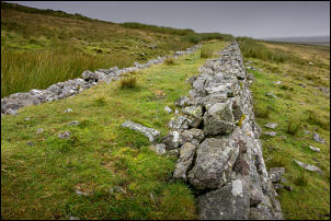 All that's left of the tramway |
| It was tough going for almost 2 miles until I reached the back of the Hartside Café. I turned left to follow the old track down past Twotop Hill to cross the main A686 Hartside Pass Road. I crossed over to descend the rough track down Moor Thwaite. Then along narrow muddy lanes to Gamblesby whre I reached the road. It was then about a mile back to Melmerby. |
 Old AA sign in Melmerby |
|
|
|