|
Weardale, Stanhope, Stanhope
Common, Reahope Moor, Co.Durham. |
|
|
OS Grid ref:
NY 96512 39856 Lat/Long: 54.753635, -02.055723 Drove via M6, Brough, and Barnard Castle to the start of my walk near Stanhope. I drove along the minor lane up towards Rookhope and parked on a grassy area near Bewdley. There was bit of high cloud around but as I walked back down the lane towards Stanhope it cleared to mostly blue sky. |
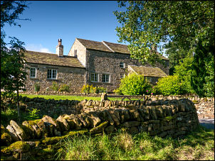 Farm by the lane |
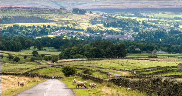 Descending to Stanhope |
|
| I turned north up the B6278 then turned left along a track into an area that used to be the massive Lanehead Quarry. The track was quite level and the 1860s map reveals that it was also a waggon way to the Red Vein Quarry and West Pasture Mine. I reached a bridge over the Stanhope Burn and this was the site of the Stanhope Smelting Mill (lead). I left the old workings and headed up the track towards High House. |
 Beehives |
| Before the house I turned off between trees, through a gate and along a track onto the moors. To my left I saw a row of beehives and wandered over to have a look, but not too close as there were plenty of bees around. I continued to an old railway wagon that is used for a sheep shelter. |
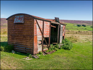 Sheep shelter |
 The spectacular shooting hut |
|
| It was very old and dilapidated and the interesting thing is that it is shown of the Ordnance Survey map. My next objective was a Shooting Hut shown on the map. Its description was a Shooting Box but when I got there I was amazed. The building was of stone and had recently been extensively renovated. |
 Inside loo |
| The doors were locked but outside were two table benches surrounded by recently turfed natural grass. I stayed for my sandwiches then continued along the track by the shooting butts. The weather continued sunny and glorious light. It the summit I was on the route of a walk I’d done last year. There was only a faint route to follow but the ground was fairly dry. |
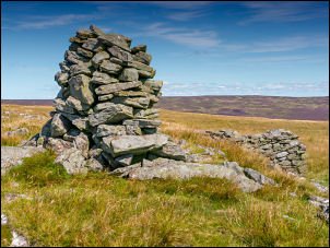 Cairn |
| I passed a cairn, sheepfold then another cairn. The whole area was marked with old workings and the old map calls it East Slate Quarry Hill. I reached the Ordnance Survey trig post at Crow Coal Hill. This is another anomaly as it is shown on the 1:50k map but not the 1:25k map. The map shows a coupdl of old shafts but there is nothing remaining on the ground, not even a hump. |
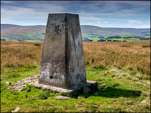 The Ordnance Survey trig post |
| I soon had my car in sight and descended by an old track back to the road. The road is one of the national cycle routes and there were a few cyclists riding along as I reached my car. |
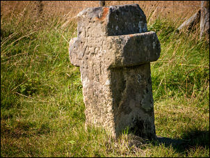 Boundary cross on the drive home |
|
|
|