|
Bowness-on-Solway, Port Carlisle, Drumburgh, Glasson,
Cumbria. |
|
|
OS
Grid ref: NY 23213 62673 Lat/Long: 54.952766, -03.200506 I drove north along the M6 in very gloomy weather. I left at exit 44 north of Carlisle to drive west to the A689 and on to Bowness-on-Solway. The weather was very misty and ark when I arrived at a small parking area by the shore. There were high tide warning posts along the road which can be underwater at particularly high tides. When I arrived the tide was high but going out. I set off east along the road in extremely dull and misty weather. |
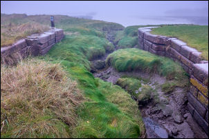 The old canal link |
|
As I reached Port Carlisle I saw a sign by the marshes warning about the
plant ‘Hemlock Water Dropwort’. == Hemlock Water Dropwort is sometimes known as Chinese celery or Japanese parsley. One root can kill a cow and has been referred to as the most poisonous of all British plants. Over 2000 years ago in Phoenician Sardinia a similar plant was used for the ritual killing of elderly people when they were unable to support themselves. They were intoxicated with the herb and then dropped from a high rock or beaten to death. Criminals were also executed in the same way. == |
 Coast path in mist and trees |
| Over a bridge I came to the remains of the lock which entered a harbour. On the seaward side was the remains of the wharf and bollard. The area was now silted up but it must have been busy at one time. This was where the canal ran from Port Carlisle to Carlisle. It opened in 1823 and was commercially very successful as Carlisle no longer needed to rely on Maryport harbour's expensive tariffs. The canal ran 11 miles into Carlisle and closed in 1853 when it was replaced by a railway that ran along its bank. |
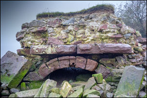 Stone arch on the beach |
| The continuing path went through woodland and emerged onto the road which I followed to a sharp right bend. I left the road and headed out across the grassy flats and some muddy ground. The path appeared to continue along the shore but when I reached a strange stone structure with a sandstone arch I realised I had gone too far and had to return. The point where the path is shown going into the fields didn’t exist so I had to climb the fence. Across the fields I came to a trig post by a gate. |
 Trig post |
| The official path continued along a track but the farmer had wired the gate shut. I was able to follow the hedge to the next gate and back to the road. At Drumbergh I turned right to follow a rough wet track which is the Hadrian’s Wall path that doesn’t follow Hadrian’s Wall. I reached Glasson and the Highland Laddie Inn & "The Haafnetters" Rest. Haaf-Netting was introduced by Norse-Gael settlers around 900AD. The word 'haaf' is derived from the Norse word 'hav', meaning open sea. It is a heritage that has almost died out but in Cumbria the tradition continues. |
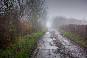 Misty, muddy lane |
| After World War II the food way rationed and there was little work available in the UK. Haaf fishing for salmon provided free food and a source of income during these hard times. The shores of the Solway Firth are the last of the places where you can still find those who practice the art of Haaf Net Fishing. |
 The Chapel |
| I followed another track that was the line of the wall vallum (defensive ditch). I reached the road and followed it back towards Port Carlisle. There was a small chapel which was open and inside was an interesting history exhibition. I followed another muddy track across the Vallum, across very wet fields to a track to Brackenrigg. Along another track I reached the road then north to Bowness-on-Solway. This is the end of Hadrian’s Wall but I couldn’t find any information boards about it. At the road I turned right and along the road back to my car. It was slightly less misty. |
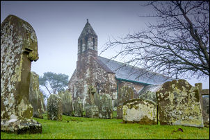 St Michael's Church in Bowness-on-Solway |
| Lindow Hall built in 1910 with funds contributed by local farmers and businessmen. |
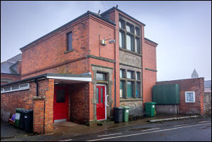 Lindow Hall |
|
|
|