|
Seathwaite, Seatoller, Honister, Stone Cove, Windy
Gap, Styhead Gill, Stockley Bridge, Cumbria. |
|
|
OS Grid ref: NY 23500
12254 Lat/Long: 54.499816, -03.182759 |
|
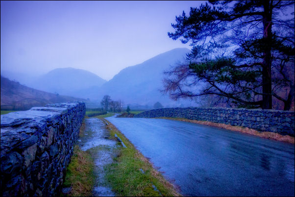 The Seatoller road in the pouring rain |
|
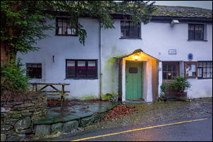
| The weather forecast was bad with constant rain predicted. I parked on the farmer’s field at Seathwaite, put £3 in the pay box and set off walking back along the road. The rain wasn’t quite as bad as I’d expected but the views of the valley were very restricted due to cloud. I reached Seatoller and stopped briefly in the bus shelter to take a photo looking out. |
 Seatoller looking out from the bus shelter |
| I continued up the steep road to Honister Hause and the rain seemed to ease a bit. I reached the Honister Quarry buildings and visitor centre at the top but they seemed closed and nobody was around. |
 Seatoller |
 Honister Visitor Centre |
 Honister Visitor Centre |
| I headed west up the old ropeway to the site of the Drumhouse where there is a substantial amount of stonework and some wood and metal remains of the Drumhouse workings. I turned south along the path heading steadily up towards Grey Knotts and it was extremely wet underfoot. |
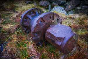 Part of the Drumhouse |
 Buttermere and Crummock Water |
 Ennerdale |
 Stone Cove and the site of an old camp |
|
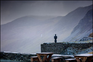
| The rain wasn’t as bad as I’d expected and I managed a view towards Buttermere and Crummock Water. Approaching Stone Cove I was able to look down into Ennerdale and a misty view of Ennerdale Water. Up ahead was Great Gable but the higher parts of the mountain were shrouded in cloud. I reached Stone Cove and visited the large boulder where I’ve camped on a few previous occasions. One reason for visiting was check for a mobile phone signal, there wasn’t one. I continued climbing up the gully to Windy Gap at the summit. The path was loose scree most of the way. |
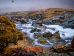 Styhead Gill |
| At the top were a few patches of snow. I started my descent of Aaron Slack which was as its name suggests very loose at the top part. I soon came to the part that had been stepped with stones making the going much easier. I followed it all the way to the bottom where I joined the Styhead Gill path. I hadn’t seen any other walker up to now but there were now a few on the path. The rain began to increase and when I reached the final steep descent to Stockley Bridge I stopped to try some photos of the river in the rain. At Styhead Bridge I took another then continued along the track back to Seathwaite in increasing rain. |
 Stockley Bridge |
|
|
|