|
Weardale, Cowshill, Coldberry End, Burnhope Moor,
Burnhope Reservoir, Co Durham. |
|
|
Lat/Long: 54.760292,
-02.228096 OS Grid ref: NY 85420 40619 Drove north on the M6 to partially redo a walk I did 5 years (Tue 24 Dec 2013) ago the reason will become clear later in the report. I left the motorway at Penrith to head east on the A686 via Melmerby and over Hartside Pass to Alston. I was here last week and the main street through Alston was closed and being resurfaced. Unfortunately they were still on with it and I had to make a diversion to the north on the A686 and then a sharp switch back to the B6294 and back to my planned route to Cowshill in Weardale. I parked on a wide verge area by the road and instead of following the very wet path to the west of the river I join the A689 which has a footpath along it. |
 Wearhead |
 Deserted Low Rigg Farm |
|
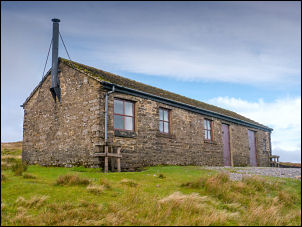
| I continued southeast to the bridge over the River Wear at Wearhead and then right along the narrow lane. A short way along I turned left into the fields heading south towards the property called Low Rigg. I could see it plainly standing out on the horizon and this is where I wanted to revisit as I’d first seen it 5 years ago and wanted to see how it was now. I looked in through a rear door and went inside briefly to inspect some very dilapidated rooms and then up the stairs and back down again. I move around to the south face which is the front of the building to enter the main front door as I had 5 years ago. | |
| Inside it was dry as the roof was still intact and it looks as though someone had been using it as old chairs were circled around the fire and one had a pile of empty beer cans underneath. Up the stairs in a room to the left was an exercise frame which still had some weights on one end. It was more or less as I’d seen it 5 years ago. I left on continued so to follow the path along a very wet farm access track which became extremely narrow as it climbed up towards the road. |
 Dead owl in Low Rigg |
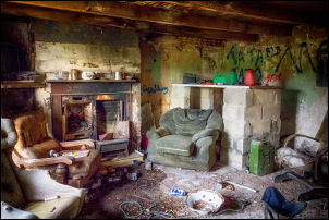 Low Rigg living room today 17th Oct 2018 |
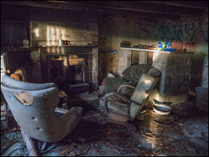 Low Rigg living room 24th Dec 2013 |
| I can only assume this was the farms original access and wondered what kind of vehicles they would have used to negotiate it. At the road was another farm building which was also empty. I reach the adopted Causeway Road and turn right to head south west and up the hill. I hadn’t gone for when the farmer came down in his truck heading towards me and stopped briefly for a chat. He asked if I was going up on the hills to camp and I said no I was just going for a walk. I asked him about the property at Low Rigg and he said the downstairs room had been used some time ago by the son of the original farmer. It was last lived in as a farm in the 1940s and apparently let out as a holiday property in the 1950s. Since then it doesn't seem to have been used for anything. | |
| I continued up the road to a gate where the tarmac finished and I was on a rough stone track heading up the hill. |
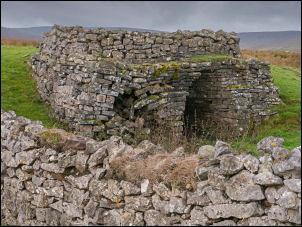 Old limekiln by the track |
| Before the summit I noticed a shooting hut to the left at West Grain and followed the access road to have a look. It was a substantial building but all the doors were thoroughly bolted and locked. I crossed the moor to re-join the track up to Cutthroat Meas and Coldberry End at the summit of the road. |
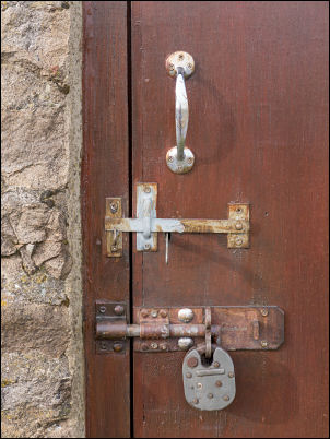 Bolted and locked |
 Shooting Hut |
|
| I continued up the road to a gate where the tarmac finished and I was on a rough stone track heading up the hill. I had a look at a small cairn which gave commanding views to the west and south down the dale. The whole area was covered in mining spoil heaps. |
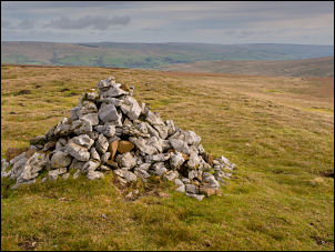 Cairn and views |
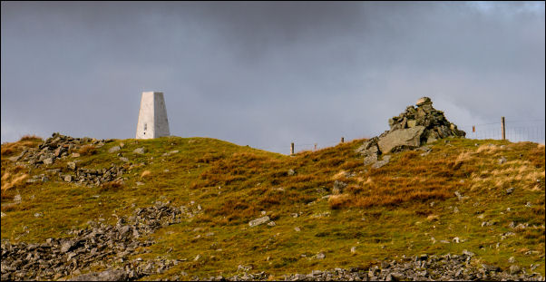 Trig Post and cairn |
|
| I left the track to head across the rough moor to a large cairn and the High Fell trig post. There were the remains of some mining buildings so I stopped to have my butties in the shelter of a low wall. I descended across the moor to re-join the track walking through an area of disused mine's and old bell shafts. At the track I descended down towards the B6277 which I could see clearly below. |
 Mining spoil heaps |
| Before reaching it I turned sharp right to follow a track past some more old mine buildings and stone stables at Manor Gill. They were in remarkably good condition but I didn't stop and continued to try and find the track. I was walking through some boggy & rushy ground and it was difficult finding the original track. It started to become more apparent as I climbed up to a quarry area which was a huge flat area of waste. Above it were some small quarry workings and then over the summit to reach a gate at the boundary. Through the gate the track slowly improved and I started a long descent across by Todd Sike and Burnhope Moor. |
 Mining spoil heaps |
|
I made a short detour to look at the car park area and the north end of the dam before turning around and heading northeast back towards Cowshill. I kept with the road all the way and on the final descent stopped at the converted church to have a look in the graveyard. I commented on it 5 years ago when the church was being converted to a domestic residence. I got back to my car at 14:00. This was the first time out for my new boots which I bought on Monday but they were actually second-hand seconds from LSR in Burnley (Lancashire Sports Repairs). |
 Burnhope Reservoir embankment |
| Construction of the Burnhome Dam began in 1931 and completed in 1937 an extensive network of narrow gauge railways, the Burnhope Reservoir railway, was used during the construction of the dam. Filling of the reservoir commenced in 1936. It was a joint project of the Durham County Water Board and the Sunderland and South Shields Water Company. It is now owned and operated by Northumbrian Water. |
The stone plaque reads: === In Commemoration of Peter Lee, Chairman of the Durham County Water Board 1920 to 1935, who by his able guidance contributed in no small measure to the satisfactory construction of Burnhope Reservoir. This memorial is the workers tribute to his great ability and constant endeavor to promote their welfare. === |
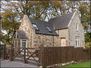 Converted Church |
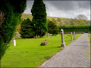 Graveyard |
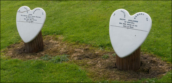 Interesting headstones |
|