|
Pike of Bliscoe, Blake Rigg, Blea Tarn, Side Pike,
Cumbria |
|
|
Lat/Long:
54.437489, -03.102480 OS Grid ref: NY 28590 05235 A nice sunny drive via Ambleside and the Langdales to the steep climb up towards Blea Tarn. Part way up I left my car in a small old quarry by the road and then set off on the main path south heading by Redacre Gill and up towards Pike of Blisco. I was the only one around and the path was excellent going in the morning sunshine. |
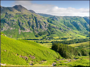 Langdale valley |
| After a short flat section the path gradient steepens but for most of the way it is a flight of stone steps making the going very easy. It soon warmed up in the clear sunshine and I was walking in my t-shirt. Eventually the steep part eased and I walking across a flat grass plateau on the final approach. Looking back there were excellent views of the Langdales. The final approach to the summit area of Pike of Blisco is a series of rocky scrambles but not too steep. |
 Stone steps up to Pike of Bliscoe |
 View up Mickleden |
|
|
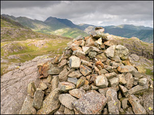
The summit area is quite wide
with two prominent rock utcrops each with a stone cairn. The easternmost
caren appears to be the highest. Acording to my GPS the north cairn is 700.4m and the south cairn 698.3m. So north has it. |
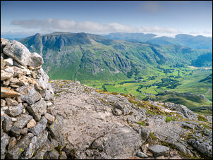 View from the summit of Pike of Bliscoe |
| I stopped for a while to take in the excellent panorama of the Cumbrian Fells. I then headed west to the next pinnacle and descended west down some steep rock scrambles to a grassy area where I then turned east where there was no path. I wanted to visit Blake Rigg cairn away in the distance. |
 View to the Langdales |
| It was around 2 km of open fell to cross but fortunately there were no boggy areas and the going was very pleasant. I reached the cairn on Blake Rigg and looked down towards Blea Tarn which was my next objective. As there is no footpath the descent was a little tricky in places on the east side of the fell. |
 Cairn on Blake Rigg |
| I headed south then southeast descending steep grassy slopes then picked my way carefully through rocky outcrops and deep bracken covered fell side until I joined the main path south of Blea Tarn. I followed it up to the footbridge and stopped briefly at the Tarn where a photographer was there with his tripod taking the conventional view looking across the tarn to the Langdale Fells. |
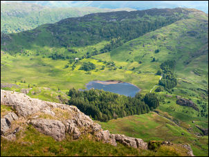 View down to Blea Tarn |
 Blea Tarn to the Langdales |
|
| I joined the path and followed it back to the road at the east side of the tarn and stop for a few moments to chat to some people in the car park. I headed north along the road then up a steep path to the right towards Lingmoor Fell. It was a substantial climb and took me to Brown How summit where I turn left to follow a narrow path which for a large length was adjacent to a wall and very dangerous barbed wire fence. | |
 Lingmoor Fell towards Pike of Stickle |
|
| In the distance was Side Pike and I made a tricky descent down a series of steep rock slabs to reach a flatter section and a path running on the south side of Side Pike. There is a famous squeeze here where the path goes between a protruding rock and the rock face on the right. However there is a diversion below so it can be avoided. It was easy to get through the squeeze but I had to remove my rucksack. Once through I reached the west side of the mountain and a series of steep descents heading back down to the road. Earlier in the morning it had been sunny but cool but now a little cloud but the temperature had increased considerably. |
 The squeeze on Side Pike |
 Jet training in the Langdale Valley |
|