Lat/Long: 54.589875, -03.366465
OS Grid ref: NY 11798 22490
The weather forecast was
good and I set off under a dark clear sky after having to
defrost my car windscreen. I’d originally planned to start my
walk from the small car park at Maggie’s bridge to the east of
Lowewater. As it is down a narrow lane I decided to continue
along the lane by the north side of Loweswater and park in the
area near Waterend. |

View from the Corpse Road |
|
I set off walking along the road in a SE direction hoping to see
some nice views across Loweswater. The sun was still low so
hadn’t yet reached the trees so didn’t get the photo I’d hoped
for. Further along the road I turned right down the lane to
Maggie’s Bridge then up the farm track to High Nook Farm. There
was nobody around as I walked through the farmyard and continued
up the stony track to the gate. |

Looking down to Highnook Tarn |
|
At the fork in the track I turned right along the old Corpse
Road and met a walker coming the other way. I left the main
track and followed a minor path to the outlet of Highnook Tarn.
The tarn isn’t names on the Ordnance Survey maps but is in
wainwrights Book. Further on I stepped across Highnook Beck and
joined the track that ziz zags up the valley. It’s the first
time I’ve been on this path and glad I’d decided to investigate
it. |
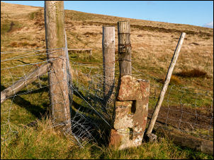
Old gate post as boundary stone |
|
The climb was ver peasant and the views soon began to open up.
After the first steep section the gradient eased as I reached
the stile and fence at Fothergil Head. I turned right up to the
stone marker post which is an old gate post with two recesses
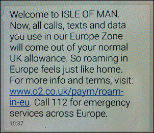
cut for gate poles. As I continued up to Blake Fell I could see
the Isle of Man out to the west. My phone also picked up O2
Roaming welcome to Isle of Man. There were a few people walking
around Blake Fell Summit and I chatted to a couple before
continuing to Burnbank Fell. |

Below Blake Fell |

Blake Fell Summit |
Below Blake Fell summit my phone picked up a signal from
the Isle of Man which I could see on the horizon |
|
|
I had a nice view don to Loweswater before starting the steep
descent down to the NW. I reached the gate and re-joined the
Corpse Road track which winds along the NE side of the fell.
There were several people and families out enjoying the fine
weather. I reached the wooden seat at the classic viewpoint but
there was already a woman on it enjoying a hot drink from her
flask. |

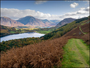
From Burnbank, Loweswater below |
|
We chatted briefly and I said I’d seen her earlier just
below Blake Fell.
I continued to Holme Beck then
descended down through Holme Wood to the south shore of
Loweswater. I turned left to follow the track and then the right
fork to the stone hut by the lakeside. There were several people
and children around. |
From the Old Corpse Road |

Loweswater |

Bothy by Loweswater |

Woodland by Loweswater |

Across Loweswater |
|
The path followed close to the shore but not along it before
re-joining the main path before the gate. Up at Hudson Place I
descended down the farm road to leave across a field to the
right and follow the path to the road and parking where my car
was. There were now many cars there. |
|
|