Lat/Long: 54.684152, -03.039614
OS Grid Ref: NY 33073 32619
The weather forecast was for strong winds. I drove north on the
M6 and off at Penrith then to Mosedale and along the cul-de-sac
road by the river Caldew towards the old mines. Some sections
were still flooded after recent rains. The weather was fine when
I arrived but there were still strong gusty winds. I set off
walking back down the lane with the intention of turning back if
the winds were too strong on higher ground. |
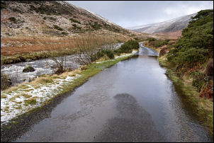
Flooding on the lane. |
Looking down to Mosedale. |

A bit of sunshine. |

Mosedale Friends Meeting House.
1702 |
|
In Mosedale village I stopped by the Friends Meeting House with
a 1702 date stone over the door. The lintel carving is
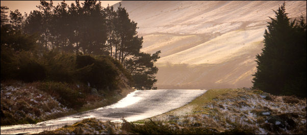
definitely relatively modern. On the road I continued north
along the wet and deserted road to an area called Apronfull of
Stones. |

Mosedale. |
|
There is a left turn along an indistinct track which I followed
to the start of the faint path called ‘Rake Trod’ which heads
steeply up below the cliffs towards Carrock Fell. The
temperature was around 2degC with a thin coating of damp snow on
the fellside. I took my time and picked my way carefully as the
slope below was steep. Fortunately the wind wasn’t too bad as I
was sheltered by the mountain. |

Heading up Rake Trod. |

From Carrock Fell towards Great Mell Fell. |
At Further Gill Syke I scrambled up the gully to more level
fell and an easier path over the grass. As I expected the wind
was much stronger but still not too bad. After passing an
ancient sheep fold the path was more difficult due to snow on
the rocks. |
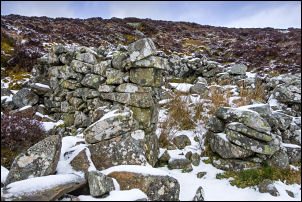
Old bield. |
|
As I approached the substantial summit circular cone cairn the
wind became very strong, gusty and tricky. I crouched below the
cairn to get a photo then then braved the very strong wind to
get over the summit. By the summit is an ancient stone structure
which the maps give a variety of descriptions from ‘Remains of
Supposed Druidical Temple’ to ‘Fort’ and is probably an Iron Age
Hill fort (c500BC). |
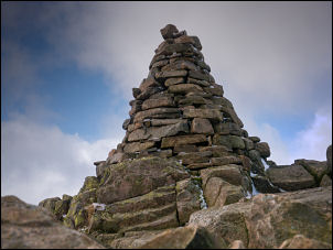
Summit cairn. |
I was planning an escape route to the east but as I ventured
down through the rocky area I reached the flatter and grassy
fell. Though still very strong I was able to battle through the
wind and wouldn’t come to much harm if blown over. I pressed on
but decided to cut the walk shorter if I could see an escape
route. After Miton Hill I could see the deep gully of Brandy
Gill to my left and turned left to head towards it. The wind was
still very strong but I was heading down and hopefully the wind
would subside a bit. Traversing the east side of the gully I
could soon see the old mine workings below. I was very relieved
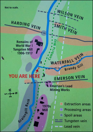
to reach the track and was pleased to see a new information
board about the Carrock Mines which wasn’t here the last time I
passed.
At one time Carrock mine was managed by two Germans,
William Boss and Frederick Boehm. From 1906 to 1912 they mined
Tungsten. |

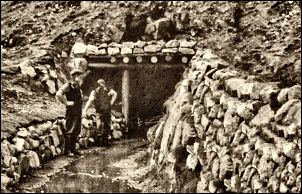
Carrock Miners |
Carrock Mines. |
|
 |

Photo taken 1916
by Walter Hemmingway
the Mines Manager |

Similar view today. |
|
I walked this way in the early 1980s and the mines were being
worked then. I had a short walk back to car and the wind had
dropped considerable but as I drove home along the M6 the wind
picked up again. |