|
|
Lat/Long: 54.684152, -03.039614
OS Grid Ref: NY 33073 32619
Had a gloomy & drizzly drive north along the M6 then on to
Mosedale, Cumbria. I have returned to investigate some new
trails I haven't been on in the area. I reached the end of the
one way road past Swinside to a grassy area where I usually
park. As I expected there were no other cars. I set off around 8
am and walked back down the road to Mosedale. |
Mosedale End Farm. |
|
There were plenty of builders' vans and one large property being
extensively renovated. I turned left to head north along the
fairly featureless road to Calebreck. On the way I crossed
Carrock Beck where I had to use the wooden footbridge as the
ford was far too deep and even would have been too deep for my
car. At Calebreck there is a parking area with 3 cars in it. I
set off west along the old mine track. It wound around the
northeast side of the fell and even with low cloud I could see
north across the Caldbeck valley. |
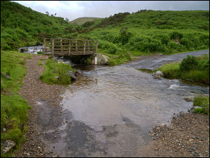
Carrock Beck ford & footbridge. |
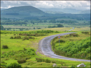
Looking back to Great Mell Fell
from Calebreck |
Calebreck Common. |
|
Passing Stony Bank I saw the extensive mine spoil heaps at
Birket and on one of the tracks found a handy spot to sit and
eat my lunch sandwiches. I was surrounded by the spoil heaps of
the Sandbed Mine which is shown on the maps as being disused
even in 1900. |

Sandbed Mine spoil heaps. |
I'd gone slightly off my planned route but found a minor
grassy path that took me back to it. I was now climbing up the
fell and crossed open ground to a series of fenced workings that
are called shafts on the map. The barbed wire fence was quite
substantial but I climbed over to have a closer look. |
Mine workings. |
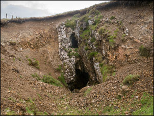
The deep excavated groove had a sloping shaft at the bottom
which continued down into the darkness. The weather continued
overcast with wind and light drizzle. At the west end of the
fence I joined the main path heading up to the Caldbeck Fells. I
turned left onto the main path and soon saw an old spoil heap to
my left so climbed up it to investigate. |
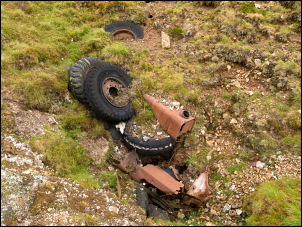
Rubbish dumped in the middle of nowhere. |
|
There had been an old heading into the mountain which was filled
in, however a clear stream of mine drainage water was issuing
out. It would make an excellent camping spot but the phone
signal was weak. I rejoined the path south and climbed up to the
pass at Hare Stones. I saw a couple of fell runners coming off
High Pike and they shouted across as they passed to check all
was OK. I continued south towards Great Lingy Hill and on to the
Lingy Hut ahead. I stopped to have a look inside before starting
my descent down the path directly below. |
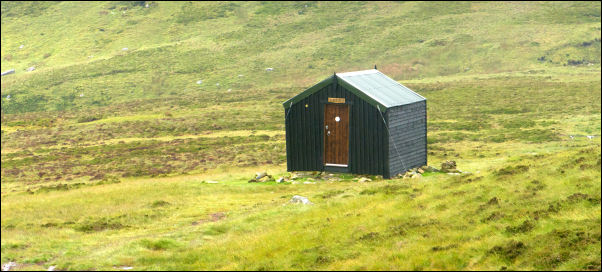
The Lingy Hut. |
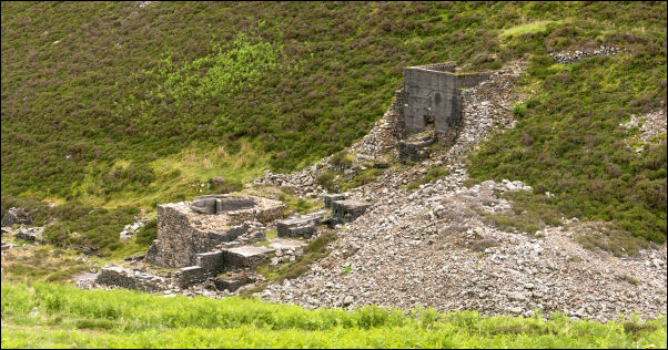
Grainsgill Mine. |
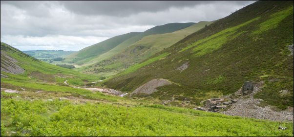
Looking back to Mosedale. |
|
I could see down into Grains Gill and the mine workings way
below. Lots of recent rain had made the slope quite wet and
slippery. soI took extra care. Eventually I reached the mine
information board and stopped to look into the mine Adit which
can be seen under the road. It was a short walk down the old
mine road back to my car. |

Mine adit c1943. |
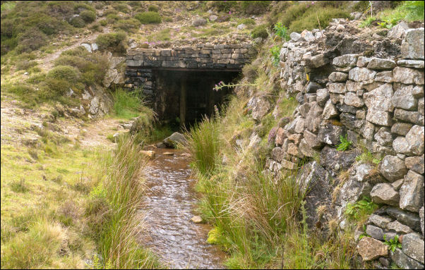
The same entrance today. |
|
|
|
|
|