|
|
OS Grid ref: NN 43280 83039
Lat/Long: 56.912090, -04.575679
After a quick breakfast I drove via Dalwhinnie to Loch Laggan
and the west end near Moy Lodge. There are two parking areas,
the westermost had lots of camper-vans so I returned to the
eastern one which was smaller but only one car. I was close to
the junction where the estate road bridge crosses the River
Spean. I set off over the bridge along the estate road and soon
reached another bridge near Torgulbin house. I realised I’d
missed my turn off and had to return to take the branch road
east and up towards the hills. The main vehicle access gate was
locked but a side pedestrian gate was open. I headed steadily
upwards passing a large gravel quarry on the left and up towards
my objective of Binnein Shuas (The Upper Peak). |
|
Further on I took a right branch to a reservoir and its dam. The
mountain loomed up to my left as I continued. I walker and his
dog came down the track and we stopped for a chat. He’d camped
the night out in the mountains and was now heading down. I
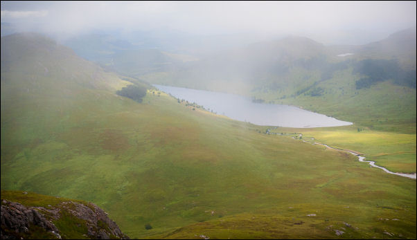
continued up to the Lochan na h-Earba which is the largest of
two lochs on this side of the mountain. There were two tents
pitched on the sandy shore but I couldn’t see anyone around. |
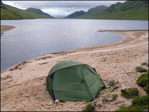
Tent by the loch. |
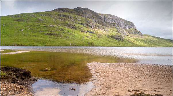
Lochan na h-Earba & Binnein Shuas. |
|
Over the bridge the track splits. The right is a loop around
across open land but I continued straight on to follow the
deteriorating track by the loch shoe. On the east side I
continued by the lock and even saw some patches of sunshine on
the mountain. The east side of Shuas has impressive cliffs
including the very difficult 'Ardverikie Wall'. In Oct 2019 rock
climber Dave MacLeod has made the first ascent of Mind Riot on
the face draded E10 7a. |
|
The map showed the only crossing of the river connecting the two
lochs was at the next loch which the map strangely gives the
same name of Lochan na h-Earba. Across to the left I could see a
concrete dam across the river. I wandered over for a look and
found it was an ideal spot to cross the river safely without
needing to go to the next loch. The mountain was up ahead and I
set off across rough ground to take a direct line. It wasn't as
wet as I’d expected and became less rough as the gradient
increased. |
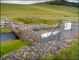
Dam and walkway. |
Binnein Shios in the distance. |
Lochan na h-Earba. |
|
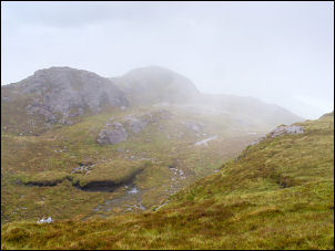
I reached a flat area with cliffs looming above. I took a very
steep climb to the right to tray and find a safe way through.
The earlier nice weather was gone and the wind increased along
with clouds and rain. After a wet grassy scramble I reached the
main summit area but still had more summits to climb. The main
summit rounded peak appeared through the mist and I managed a
quick photo of the small cairn before continuing over the top. |
Across the summit. |
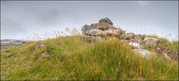
Binnein Shuas summit. |
I started my descent to the SW and thankfully dropped below the
cloud level to see the descent route below me. It was mostly
straightforward but lower down deep wet grass over rough ground
made the going difficult. I met a walker coming up and it turned
out he’d been in one of the tents I was by the loch. I reached
the vehicle track and turned right to head down. The 3km walk
back was uneventful.
Back at my car I drove back to the A9,
Trinafour, Kinloch Rannock to spend the night by the
Schiehallion Road. |
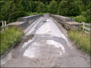
Estate bridge. |
|
|
|
|
|