|
|
OS Grid ref: NY 35719 31956
Lat/Long: 54.678543, -02.998431
After very heavy rain yesterday I was expecting the fells to
be wet. The forecast for today was for overcast but when I
arrived at Mosedale it was light rain. I parked in the laybye by
the old Mosedale bridge over the River Caldew. I set off in full
waterproofs heading south along the road to Mungrisdale. |

On the way to Mungrisedale. |
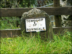
Boundary stones. |

Boundary stones. |
|
|
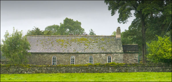
St Kentigern's |
|
I was hoping to have a look inside St Kentigern’s Church but
when I checked the door it was locked with a message saying it
is only open for a weekly 11am service. I headed west along the
track by the River Glenderamackin. Some years ago the path by
the river had been washed away and a diversion across wet ground
had been pegged out. I now found they had placed large stone
slabs along the line of the diversion. |
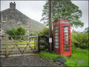
A telephone box that doesn't take money |
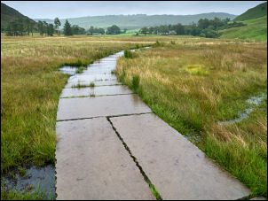
Flagging for the footpath diversion. |
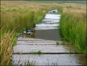
Sagging flagging. |
|
It looked fairly recent & when I did an on-line check the order
was dated Nov 2019. They were easy to walk along but further up
a few had started to sink into the mire and some boulders were
needed as stepping stones. I crossed over the footbridge then
followed the lower footpath to the south by the River
Glenderamackin. That had also had sections washed away but there
was no diversion so I had to do a lot of climbing down and up to
get through. The whole fellside was running with water and it
was difficult keeping out of the running water. |

A very wet path. |
Looking up Bannerdale East ridge. |

Looking down Bannerdale East
Ridge. |
|
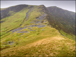
The cloud was low and I still couldn’t see my objective of
Bannerdale Crags. I reached the ford at Bannerdale Beck and as
expected it was impassable as the river was in spate. I walked
upstream for a while until I reached a wide section where I
could take my boots off and wade across without difficulty. I
climbed out of the valley and joined the path heading up the
ridge towards Bannerdale Crags. It is odd that the path isn’t
shown on the O.S. map. The cloud had lifted a bit and I was able
to see the whole ridge ahead. Higher up were old mine workings
and a reasonable stony path winding through them. The whole area
is very impressive even in bad light. In Wainwright’s ‘Northern
Fells’ he refers to this route as the East Ridge and “a grand
scramble in an impressive situation - a bit of real
mountaineering.” |
I reached the summit cairn and headed NW along the edge of
Bannerdale Crags. In the distance I could see the rounded summit
of Bowscale Fell but I had another stretch of wet ground to
cross reach the final drier approach path. |
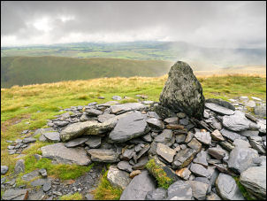
Summit cairn Bannerdale Crags. |
Over the top I continued north and the descent to the edge
of the impressive bowl around Bowscale Tarn. Down by the tarn
edge I could see a couple say by a boulder appearing to have
their lunch break. They were the only people I’d seen all day. |
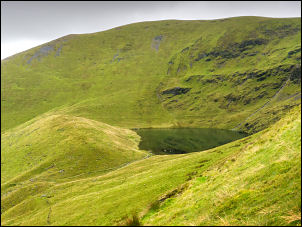
Bowscale Tarn. |
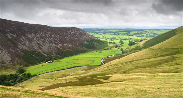
Looking down to Mosedale. |
|
|
I continued down then right along an old green track to the
descent path by Tarn Sike. Eventually I reached the valley
bottom by the River Caldew and the footbridge to the Roundhouse
buildings. Then I was spoon on the road and an easy walk back to
Mosedale and my car. |
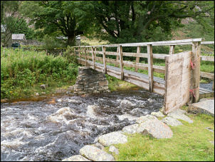
Footbridge near the Roundhouse. |
Crossing the old Mosedale Bridge. |
|
|
|
|
|