|
|
OS Grid ref: NY
Lat/Long: 54.6612060, -2.9861450
|
Before setting off for my Cumbria walk I checked the Google
maps site for any traffic problems on the route. My heart sank
when I saw the A66 from Penrith to Keswick was shown as closed
until 11am. It wasn't too disastrous as I knew there was an
alternative route by getting off the M6 at 41 but that would
have taken longer. The weather forecast was also bad with lots
of rain on the way. |
|
I set off along the motorway and kept an eye on the information
boards. They all seemed to be switched off but over Shap I saw
one but had no mention of the A66. I decided to get off at
Penrith and check it out. There was no closure and the road was
clear so I got to Mungridale as planned. I parked on the muddy
roadside layby and set off along the road passing the Community
Centre. |
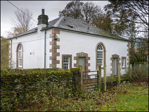
The old school. |
|
I passed St Kentigern church on the right and a short way on
turned into the minor track on the left. I soon came to a tied
up wooden gate but the write fence to the right was loose so I
strode over it. ON the left is the large Old School Building
which is very impressive. The rough track continued up Bullfell
Gill which I find puzzling as there isn’t a Bull Fell nearby. |

Heading up Bullfell Gill. |
|
The O.S. map doesn’t show a footpath along here but it is
referred to in Wainwrights 'Northern Fells’ book. The map shows
a small building further up but no indication what it is.
Wainwright calls it ‘Waterworks Building and Recording
Apparatus’. When I reached the concrete box building it was
certainly some sort of water intake valve house taking its water
from a spring issuing from the hillside. |

Waterworks intake building |
It was a considerable height above Bullfell Beck below. The
narrowing track continued to a collapsed sheefold and then a
narrow path continued. I picked my way through patches of
heather as I climbed out of the head of the valley towards
Bowscale summit. |
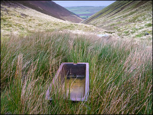
A ceramic trough further up the valley. |
I couldn’t see the summit but soon reached the path coming
in from the right and joined it to the stone wind shelters. It
continued overcast with low cloud and I was expecting the rain
to arrive at any moment. |
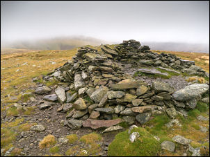
Bowscale Fell summit. |
I descended south towards Bannerdale then right to the
saddle below Blencathra. I descended the easy track down along
the River Glenderamackin to the footbridge. I had a plan ‘B’ for
if the rain had arrived but it hadn’t. I climbed to the top of
Mousethwaite Comb and if the rain had hit I would have descended
straight down to the road. It hadn’t, so I followed the path
over Souther Fell. A bit of rain arrived but didn’t last long. |

Wooden footbridge
over River
Glenderamackin |
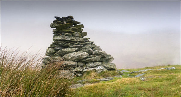
Souther Fell cairn. |
|
|
|
After visiting the tall cairn I continued to turn right across
wet ground to descend the shepherds track diagonally down to the
road as Lower Beckside. Lower down I met some family walkers
heading up. Walking back along the road there were several
people walking up the lane. I crossed the footbridge and stopped
to look at the Mungrisdale Recreational Room dated 2004. As I
got back to the car I was surprised that there weren't more cars
parked. I was just in time ast the rain started and continued
for most of my drive home. |

Mungrisdale Recreation Room 2004. |

Mungrisdale Recreation Room 2004. |
|
|
|
|
|
|
|
|
|