|
|
OS Grid ref: SD 65942 11377
Lat/Long: 53.5978510, -2.5160920
|
|
|
Set off on another walk from Horwich, Over winter Hill and back
home but by a different route. As my bus pass didn't come into
effect until 09:30am I walked to the Hardacre Lane stop where
the bus is scheduled to pick up at 09:31. The 125 bus arrived
exactly at 09:30 but I was OK with my pass. The weather was much
better than last week and I could see some sunshine. Through
Horwich I continued up the hill and got off at Georges Lane bus
stop. I started walking along Georges Lane for a short way then
right up a muddy path to the higher road of Matchmoor Lane. |

Georges Lane. |

Horwich Sports Stadium from Matchmoor Lane. |
I had clear views as I walked along the lane and could look out
across Horwich and Bolton. I took a left turn at Burnt Edge Lane
and continued up along a deterioration track. Eventually it
became a path but was firm and stoned so easy to follow. It took
a few twists and turns until I approached the main access road
to Winter Hill transmitter masts. I didn’t go that far but
stopped a while at the site of the Winter Hill Brick and Tile
Works. There are some remains to be seen but not much historical
information about it.
Dave Lane's researches have come up
with the following:
The brick works were probably once known
as “Five Houses Fire Brickand Tile works” as can be seen from an
advert in the Bolton Chronicle on the 19th February 1849 which
read:
TO BE LET. An extensive and well established Fire Brick
and Tile Works,situated at the Five Houses, Horwich Moor, the
present proprietor being desirous of retiring from the business.
The works are complete with Steam Engine, Grinding and
Crushingapparatus, Stoves, Drying Houses, Ovens, Moulds and
every convenience for carrying out business.The clay and coal
being of superior quality, and are got on the premises at very
trifle expense. |

Winter Hill Brick and Tile Works.
|

Kestrel overhead |
To the north is an old tramway to a couple of old mine
entrances so I followed the track and could see some brick
surfacing. The mine entrances were filled in. |

Paving on the old tramway. |

Working on the transmitter mast. |

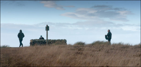
Scotchman's Post on the left. |
==
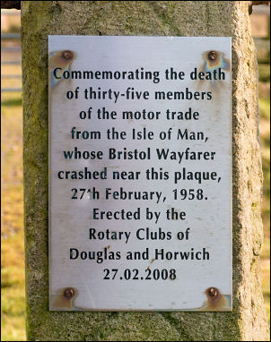
Commemorating the death of thirty-five
members of the motor trade from the Isle of Man, whose Bristol
Wayfarer crashed near this plaque, 27th February 1958. Erected
by the Rotary Clubs of Douglas and Horwich 27.02.2008
== |
Two Lads main cairn. |

Gateposts on the Chorley / Blackburn with Darwen border. |
Carved in the stone post below the paque is an Ordnance Survey
benchmark. It is the height above Ordnance Survey datum which
used to be the mean sea level at Liverpool but is now mean sea
level at Newlyn, Cornwall. At one time there were around 500,000
benchmarks but this one is of particular interest as it is the
highest in the Chorley District at 446.92m (1,466.27ft) above
sea level (Newlyn datum).
I have included a map from 1910
showing the altitude at 1466.5ft (Liverpool datum). The datum
changed from Liverpool to Newlyn in 1921. |

Benchmark. |

Distant view of Preston and the Round Loaf Barrow, |

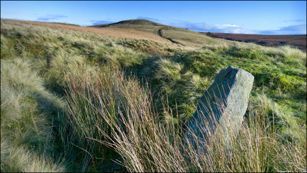
Hordern Stoops. |

St Peter's Church Belmont. |
|
I crossed to the road and followed it to the old stone gate
posts where there is a marker for the Winter Hill Air Crash
disaster of 1958. Under it is an O.S. benchmark shown on the map
as being 1466.5ft. I didn’t visit the Trig Post and the descent
from there to Hordern Stoops is horribly wet. Instead I took a
route round the back of the masts and a direct path down the
hillside to the car park above Ward’s Reservoir (Blue Lagoon). |

Path along Spitlers Edge. |
Great Hill. |
|
It was a steady descent though steep at first but nothing like
as wet and last week's route. At the car park I walked up the
road to Hordern Stoops and followed the Spitlers Edge path along
the stone slabs. The weather continued fine and although some
stones were just underwater I kept my feet dry. At Great Hill I
didn’t stop but kept on to Drinkwater’s Ruins where I had a
close look around the back for a possible camp pitch. I then
checked out the spring below the track then continued to White
Coppice, Heapey Lane and Town Lane home. |
View of Great Hill from above Drinkwater's ruins. |
|
|
|
|
|
|
|
|
|