|
|
OS Grid ref: NY 33911 26711
Lat/Long: 54.631184, -03.025281
|
There continued high pressure with hardly any wind as I drove
north to Cumbria. It was a pleasant sunny morning when I arrived
at Scales and parked in the vehicle lay-by. There was heavy
traffic as I set off walking east. I left the busy A66 and
turned right down the minor road which descends to Lamb Bridge.
I was annoyed with myself because there was a perfect parking
spot here but I wasn't aware when I arrived earlier. I left the
road to turn right along a minor lane through open fields to the
small Hamlet of Wallthwaite.
|

Great Dodd and Clough Head in the distance. |
Up ahead I could see the fells but before reaching them my
first objective was to have a look at Mosedale Viaduct which
used to carry the Railway over Mosedale Beck. The viaduct is
visible from many of the walks on Blencathra and it intrigued
me. Unfortunately there is no public footpath adjacent to the
structure but one passes close by to the east. |

Mosedale Viaduct. |

Mosedale Viaduct & Clough Head in the distance. |
I left the road at Wallthwaite to
follow the path through the field heading south east. It crosses
the railway at a footbridge but I kept to the west field
boundary to get closer to the viaduct. I reached the edge of the
deep valley and was able to to step over the fence onto the old
railway route below. A substantial fence prevented access to the
top of the viaduct but I was able to step over the fence and
descend the steep slope to the valley bottom where I had a good
view.
==
from Wikipedia
https://en.wikipedia.org/wiki/Mosedale_Viaduct
The Mosedale Viaduct carried the
Cockermouth, Keswick and Penrith Railway over Mosedale Beck
until its closure in 1972.
Building work on the viaduct began in
1862, and the first test train crossed it in 1864. It is made of
stone and has 12 arches & was built single-track but was
extended to the north in 1900 to accommodate two tracks. Since
the structure was widened, three of the piers have been
reinforced in concrete.
Despite the line suffering heavy
losses in the 1950s and being earmarked for closure in
Beeching’s 1963 report, the Penrith-Keswick passenger service
survived until 1972.
In 1997, the BR Property Board agreed
not to demolish the Viaduct as a proposal to reinstate the line
as far as Keswick is being progressed with some political
support.
== |

Mosedale Viaduct. |
|
I climbed up out of the valley following a fence line and
was able to step back into the field and rejoin the official
public footpath. It continued south passing the property of
Highgate where there were plenty of new lambs in the fields. At
Highgateclose I decided to leave the field path and head east
through a gate to join the access track to the property of Lobbs
about 1 km to the south. |

Bridge & path over the railway. |
|
Before the property entrance I went through a gate to continue
on the path which is a bridleway. They sign says it could be
impassable to horses in wet weather. I last came this way in
2003 on a backpacking trip and still remember the horrible wet
moss I had to cross. I continued south and even though the
weather has been dry for a long time the ground was still very
wet. |
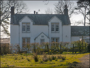
Highgateclose. |
|
I could see a gate up ahead but a path marker post took me away
from it and over the river out into boggy land. I managed to
rejoin the official path and followed it as best I could cross
Sandbed Moss. The old map calls it Flaska Common. In wet weather
this route would be very unpleasant. Thankfully I reached the
Old Coach Road without incident and turned left for a short way. |

On the Old Coach Road. |
|
My next objective is Great Dodd and the path would take me
around to the east to Groove Beck Fold. I decided to take a
shortcut and head straight up the spur which wasn't too steep.
At the top I followed a minor path which eventually joined the
main path towards the fell summit. I could see a walker up ahead
and overtook her shortly afterwards. There were also two young
men with mountain bikes who were riding up ahead. When they got
off to push and I was able to catch them up and have a short
chat. I reached Great Dodd in lovely still, warm weather but the
views were quite hazy. |

Cyclists on Great Dodd. |

Cyclists on Great Dodd. |
|
To the east is a minor summit with a stone shelter so I headed
for it before returning back to where I'd come. I descended on
the steep path down towards Calfhow Pike. There were plenty of
people around now but I soon left the main path to descend
easily down to Mosedale Beck. I follow the path down to
Rowantree Fold, which is a stone sheepfold. |

Rowantree Fold |
|
The route from here is extremely wet even with the recent dry
weather. I reached the Old Coach Road and turned right to follow
it back towards the route I'd taken earlier. I decided to avoid
Sandbeds Moss and turned off the track at Barbary Rig to head
north east across Barbaryrigig Moss. Part way I found a faint
path and followed it fairly easily to Caral Beck. |

Blencathra. |
|
A short way on I regained and the path that I'd walked on
earlier. Remembering the problem of the diversion market near
Lobbs I ignored that route and headed straight for the gate I'd
originally seen. It was a much better way and through the gate I
descended to the Lobbs track. I continued north and didn't
bother with the field path and followed the road back to
Wallthwaite. I was now on my original route and followed it back
to the car. |

Garage Bridge. |
|
|
|
|
|
|
|
|
|
|
|