|
|
OS Grid ref: NY 26623 37108
Lat/Long: 54.723584, -03.140769
|
|

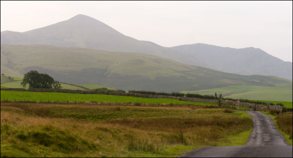
Longlands Fell. |
|
A bit of mist on the motorway as I drove north along the M6. I
left the motorway at Junction 41 to head west towards Hesket
Newmarket and on to the minor road to Longlands. I found a
decent parking spot off the road by an old quarry access track.
The weather continued cloudy with mist and low cloud. I set off
south along the narrow Lane to pass the buildings of Longlands
then down the steep hill to Longlands beck. I left the road here
to go through the gates on the left onto the old track but
turned immediately right to head roughly southeast up a
reasonable grassy path up Longlands Fell. Just as I started to
climb there was another climber infront checking his phone. I
said good morning as I passed and headed upwards. |

Lowthwaite Fell. |
|
I was going slow and steady and he soon caught up and overtook
me. I reached the summit cairn and could just see the adjacent
hills. I'd originally planned to head straight for Braefell but
the walking was very pleasant so decided to to continue south
and walk over Lowthwaite Fell as well. There was a steep descent
at first and some indication that the weather was clearing
slightly. Later on this proved false. There was a steady climb
up to Lowthwaite Fell summit and no obvious cairn. Off the path
were a few stones that I would consider as an insignificant
cairn. I continued over the top then gently down where the path
leveled out across Broadmoss. |
|
I took shortcut across the moor to pick my original route to
continue up towards Brae Fell. It was an easy walk as the
gradient eased. Braefell summit has quite a large cairn and an
outer area of inst stones which give the impression of an
ancient structure. The main path continues down to the north
east but I have decided to descend almost west along a minor
path which isn't shown on any map. It is quite clear on the
ground and descends steadily and easily down to Charlton Gill. |

Brae Fell cairn. |

Reaching the road looking NE. |
|
It is obviously well used by walkers. I reached the small river
in the gill and the path continued up the far bank to join the
main path higher up. The path now continues north across Lodness
and descends steadily to the main Cumbria way path. Once here I
crossed over to head for the farm buildings of Norman. Although
a track is shown on the online map there was nothing to see on
the ground. As I approached a wall and and trees behind and a
path emerged. I continued to a couple of gates that took me into
the farmyard which doesn't seem to be a working Farm. I turned
sharply left to leave by another gate and through a large field
full of sheep. Once through I passed through another gate to
follow a track then path across the open moor back to the road.
It was then a short walk back to my car. |
Longlands Fell. |
|
|
|
|
|