|
|
OS Grid ref: NY 30429 37372
Lat/Long: 54.726502, -03.081757
|
|
|
I had an easy drive north along the M6 motorway. The lane 3
barriers north of junction 36 have now been removed after many
months. Apparently to enable new central barriers to be fitted.
I reached Fell Side and was the only person there and under a
clear sky, though the sun hadn’t reached yet. I set off south
along the old mines track enjoying the sunlit views of
surrounding hills. |
Sunny view of old mine workings. |

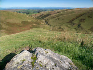
Across the Solway Firth to Scotland. |
|
Just over the footbridge across Hay Gill I took a minor track to
head up Birk Hill. The start was through deep ferns which
thankfully weren't too wet. As I got higher and above the ferns
the track was an easy climb back and forth until the higher fell
where it vanished. The sky was clear and I had excellent views
across the Solway Firth and the mountains of Scotland. My
mountains app said the furthest mountains were 80Km away. At the
top of Birk Gill I stopped for an early lunch then continued
across rough pathless moor across Birk Moss towards Hare Stones. |
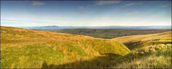
Across the Solway Firth to Scotland from my lunch stop. |
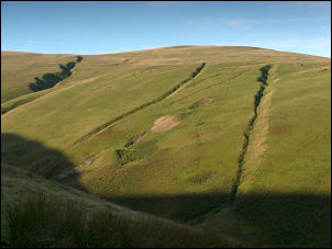
On the final climb I came to an old mine adit and spoil heaps.
The map shows it as a China Clay Mine but the old maps don’t
show it.
==
Below notes from an internet search:
Hare
Stones Umber Mine/china Clay Mine
More information : Remains
of a 19th-century umber mine, briefly worked for china clay in
1883 before reverting to umber. All mining activity here
presumably postdates 1863, for nothing is shown on OS mapping of
that date. The mine was closed and the machinery sold off
1894-5.
Aerial photographs show a series of shafts, and a
spoil heap. A trackway runs off to the north-east. The Hare
Stones Umber Mine is situated at NY 311 347. Originally worked
for umber, Messrs Woof and Garth re-opened it in 1883 as the
China Clay Mine, and worked it for one year. About 1885 the
Cleator Iron Ore Company acquired the mine, and extracted umber
until 1894-5 when the mine closed. The company constructed an
umber crushing and refining mill at Roughtongill Head for the
umber (NY 33 SW 72) which was connected to the mine by an
'overhead tramway' (NY 33 SW 74). Shaw adds that the mine
comprises a short cross-cut adit to the Roughton Gill South
vein, with drifts then driven along the lode which is composed
of umber and hypersthenite - a type of china clay.
Nothing is depicted at this location by the Ordnance Survey in
either 1863 or 1900. Modern OS maps, however, describe the site
as China Clay Mine (disused), and show a Level at NY 3113 3463
plus a waste heap (not named) immediately north of the mine
entrance.
== |
|
I climbed up through the rocks onto the flat moor to join the
main track to the Lingy Hut. By now a few clouds had rolled in
but the earlier chilly weather was now getting warm. I was now
on the Cumbria Way path and in the area of the Lingy Hut was
horribly wet after the recent heavy rains. Even after crossing
Grains Gill it didn’t improve on the climb of Knott. There were
still excellent views and in the distance I could see my planned
route to Brae fell. |
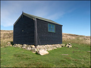
Lingy Hut. |
Great Sca Fell |
|
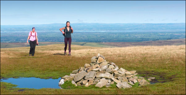
I made a decision to alter it and descend via Yard Steel
instead. I crossed the wet & boggy path to Great Sca Fell where
a couple of lady walkers were coming up the other way. We
chatted briefly and they asked me to take their photo on their
phone, which I gladly did. They headed off towards Knott and I
took a decent path towards Yard Steel. The path isn’t shown on
any map but is well used and good underfoot. I’m glad I decided
to come this way. |
|
The views were impressive and as I began the gentle descent of
the grassy ridge the impressive Roughton Gill opened up in front
of me. Before the valley bottom I came to a flat spot which was
big enough for a tent. It would be a good camp spot but the
water would have to be carried up from the river below. I
reached the junction of Dale Beck and Swinburn Gill below but
there was no bridge so I had to hop across without getting my
feet too wet. I was now on the main old mine track and followed
it back to my car. |
Looking down Roughton Gill. |
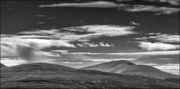
Distant view of Skiddaw. |
|
|
|
|
|