|
|
OS Grid ref: NY 31847 25601
Lat/Long: 54.6209290,-3.0569940
|
|
|
There are several routes up to Blencathra via the south side.
Probably the least used is the one via the higher reaches of
Blease Fell shown in Wainwright's guide book. I started the walk
from the car park in Threlkeld and headed up the path by the
gill. Through the gate at the wall I headed straight up the
fellside with the wall on my right. The path was easy and
distinct but the route shown in Wainwright doesn’t follow a
defined path higher up. |
Ruined sheepfold. |
|
|
|
|
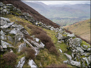
I continued north along the steep fellside with Blease Gill
below. It was tricky going for a while trying to find the best
way through the heather. My first objective was an old stone
sheepfold and I eventually reached its remains. It is on a very
steep slope and probably the most difficult location for a
sheepfold that I’ve visited. There is no flat ground anywhere
and the walls have been collapsed for many years. Up ahead is a
junction on Blease Gill and my way is to the right. Wainwright
says the bed of the gill is impassable so I had to start my
ascent above it through difficult deep heather. |
Looking up the 'gulch'. |
|
|
|
|
|
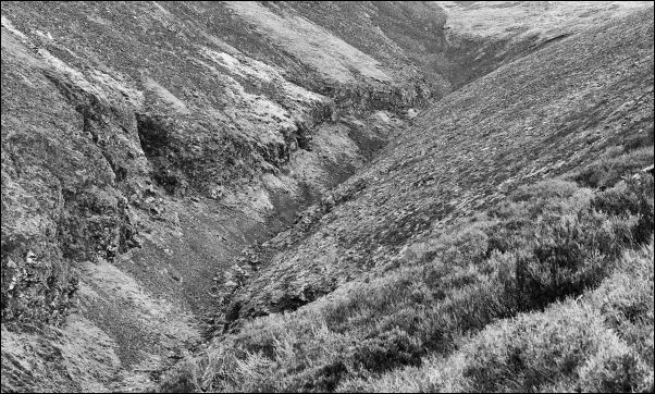
To the west I could see what looked like a reasonable path
reaching the gill junction from the far side of Blease Hill. It
may be route to investigate in the future. I continued up and
descended to gill bed as suggested by Wainwright to reach “The
canyon - Wild West stuff - ‘gulch’ might be a better word.”
Overall he describes the walk as “Hard travelling over tough
ground and wastes of scree making this no route for genteel
walkers, but rough-necks will enjoy it.” |
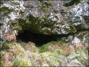
The cave, wet inside. |
|
It was much easier ground to follow as I occasionally hoppe
across the river to find easier going. I climbed up the north
side to investigate a cave entrance but it turned out to be
shallow and very wet inside. Higher up there was a welcome strip
of grass that headed up to the right and the summit ridge of
Gategill Fell. There was a flat spot just before the top which
was big enough for a tent but no water nearby. |

Looking down the gorge |

Looking back down Gategill ridge. |
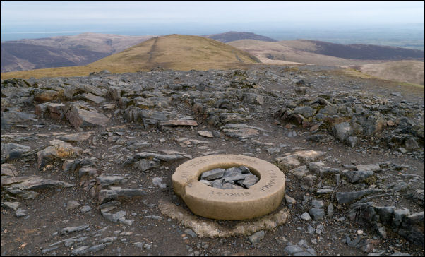
Summit Ordnance Survey trig point marker ring. |
|
|
|
I followed the path up towards Gaergill Fell Top where the last
bit is a diagonal scrabble across scree. At the top the position
is marked with a small cairn. I was then on the easy path to
Hallsfell Top and the Ordnance Survey circular trip point. The
weather continued clear but slightly hazy. I then descended to
the east via the main path down to Scales Fell and the busy A66.
Then to Threlkeld and up to the car park along the path by the
lower reaches of Kilnhow Beck. |
|
|
|
|
|