|
|
OS Grid ref: NY 31263 23077
Lat/Long: 54.598176. -03.065447
An overcast but clear drive for my journey to Wanthwaite Bridge.
As I was about to leave on my walk another car turned up and we
exchanged a few words before I continued. I was pleased that the
house by the bridge now had a ‘sold’ sign on it and not the ‘for
sale’ that been there for ages. Walking south along the B5322
was uncomfortable due to the speeding commuting traffic.
|
|
Up ahead I could see Fisher’s Wife’s Rake heading up into the
cloud and looking daunting. I was heading for the access track
to Bramcragg Quarry but before reaching it took a short cut up
through the trees. The main advantage of that was to escape the
traffic. I continued up the track to the old quarry area that is
now a sort of depot with some fresh cut wood in piles. I soon
headed up and through a wonky gate tied up with wire. Once over
the gate I turned left to follow a faint path up by the wall. |

Bramcragg Quarry. |

Bramcragg Quarry. |
|
Higher up the ground cleared of wet ferns and I joined the path
to the right that roughly follows the contour to the base of the
rake. This is where I went wrong on previous times to find the
best way up. I continued too far and this time I found the
correct uphill path that follows the left side of the Rake
keeping close to the base of the rock face on the left. It was
intermittent but showed signs of previous use. |
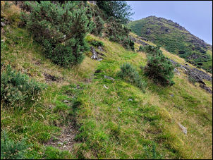
Heading up the Rake. |

Above Fisher's Wife's Rake. |
|
Higher up it crossed the Rake with a very steep drop off to the
right but thankfully soon reached the zig zag grass path that
continued up the buttress. I was now on good ground with good
views for a while but they soon vanished as I reached the cloud
level. I stopped at the stone built Jim’s Fold and managed to
find some shelter for an early lunch. |

Jim's Fold in the mist. |

Clough Head summit. |
Above the fold I took a direct and mostly pathless route
to Clough Head summit where there were no views thanks to the
mist. I took a few photos on my phone then continued NE to start
my descent to the Coach Road. A couple of ladies were climbing
up as I left. |
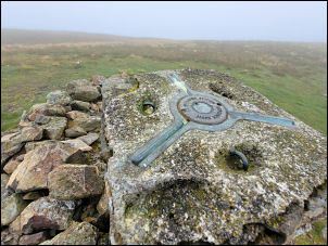
Clough Head Ordnance Survey
trig point, |
Looking down to White Pike. |

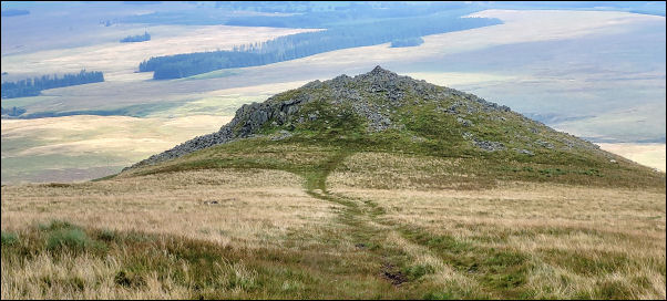
Ancient Hut Circle. |
|
|
|
Before long I was below the cloud and had good views down to the
track. Down Hausewell Brow the track flattened for a while then
I left it to decent to the old settlement of stone enclosures
and hut circle. After that I rejoined the Coach Road and
descended to the Hydram Pump near Hill Top Farm. It is
interesting that it is shown on the map. I could hear it as I
approached and walked into the field to have a close look. It
looked like it was getting regular visits for possible
maintenance. I returned to the track and back down to my car. |

WBlake's HYDRAM.
John Blake Ltd Engineerins,
Accrington,
Lancashire. |

Hydram water pump. |
|
|
|
|
|